Where to Run in Santiago: 8 Curated Routes for Easy Runs, Speed, Long Runs & Hills
Whether you’re in Santiago for a week, here for a few months as a digital nomad, or you’ve lived here forever and just want a better go-to list, this guide is for you. I put it together because finding good running routes in a new city can be weirdly time-consuming (I definitely spent time researching and testing them haha), and sometimes you just want to know where to go.
These routes cover a mix of needs — some are perfect for long runs and tempos, others are better for easy jogs and repeat loops. I’ve curated them so you can quickly match a route to what you want that day. And everything is also organized by neighborhood, with quick notes on effort and workout type, so you can choose something that fits both your run and where you’re staying.
I’ll keep updating this guide as I test more routes. Here’s what the labels mean:
Legend:
✅ Personally run
🧭 On my list (researched + vetted, testing soon)
More Santiago planning help:
Santiago 1-day itinerary → Ultimate full-day walking route to hit the city’s highlights
Santiago in 3 days → Landmarks, neighborhoods, viewpoints, markets, and modern Santiago organized into 3 logical days
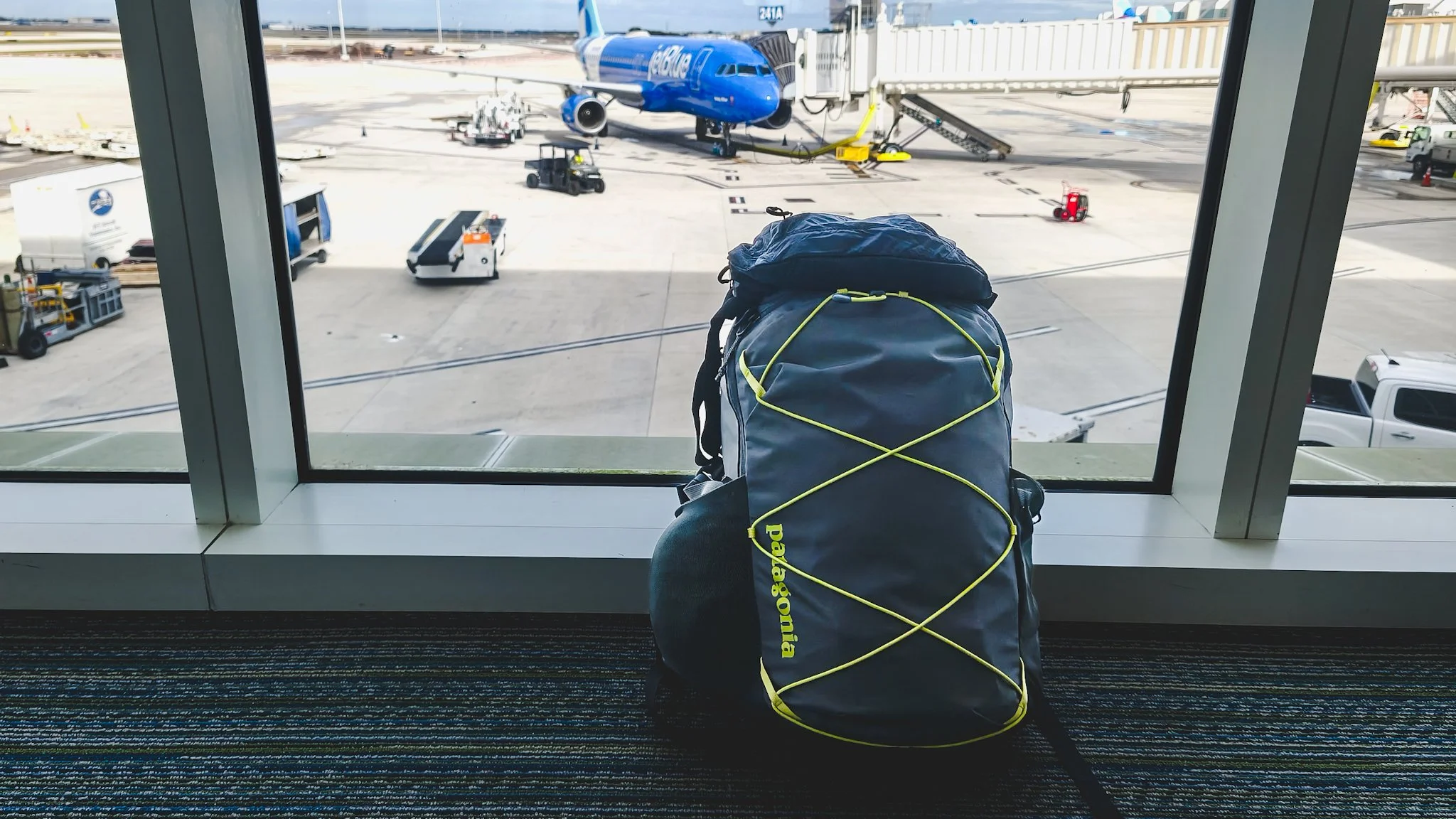
What to pack for Santiago → Carry-on layering system for Santiago’s sun and temperature swings
Where to stay in Santiago → Best neighborhoods, safety, and centrality (from lived experience)
SCL airport to the city → All transport options, costs, convenience, and local tips
Getting around Santiago → How to use the metro like a local (bip! card, best lines, safety, rush hour)
Santiago “start here” → Running list of itineraries and guides, updated regularly
Quick Finder: Choose Your Route in 30 Seconds
Below is a quick list of routes that work well for different types of runs. I go into details for each route later — scroll down for the full breakdowns.
Legend: ✅ Personally run • 🧭 On my list (researched + vetted, testing soon)
A flat, easy run
Parque Bustamante ✅ (crowded, great for people watching)
Mapocho River Corridor (Park Loops) ✅ (loops around Parque Forestal, Balmaceda)
Parque Araucano 🧭 (wide paved loops, more expansive)
Longer, low-stop effort
Sunday CicloRecreoVía ✅ (car-free avenues on Sunday mornings)
Mapocho River Corridor (Linked-Parks Route) ✅ (Parque de los Reyes → Parque Forestal → Balmaceda → beyond)
Hill training or a challenge
San Cristóbal Hill ✅ (long sustained climb, rewarding views)
A short loop you can repeat (interval or steady efforts)
Parque Forestal ✅ (best for fast repeats, especially early AM)
Parque Bustamante ✅ (best for easy days off-peak)
Parque Balmaceda ✅ (more open, steady loops)
Soft scenery + wide paths (Las Condes/Vitacura)
Parque Bicentenario 🧭 (flat, scenic, open, but a bit out of the way)
Parque Araucano 🧭 (relaxed loops in a modern park)
Overview Map: Running Routes in Santiago
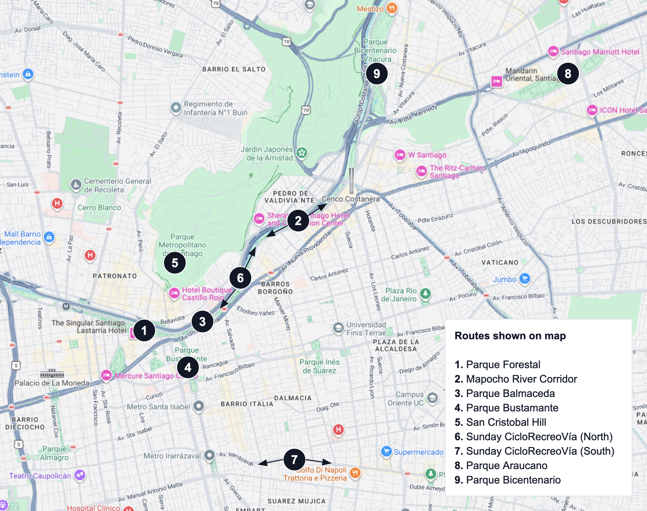
Numbers correspond to routes in legend • Central Santiago on the left • Las Condes / Vitacura on the right
Running in Santiago: What to Know Before You Go
Best times of day
Two things matter most: sun/UV exposure and crowds.
Mornings (best overall): Cooler temperatures, lower UV, and fewer people on the paths.
Afternoons (least ideal): Strongest sun and UV exposure plus routes are most crowded.
Early evenings: Less intense sun, but popular parks can still be crowded.
Night: Quieter overall, but some parks and sections can feel empty — stick to well-lit, busier areas.
Tip: Santiago’s UV can be intense year-round, so I recommend always wearing sun protection (hat, sunglasses, sunscreen).
Sunday CicloRecreoVía
On Sundays, several major avenues close to cars and become a huge multi-use corridor. You’ll see lots of cyclists, skaters, runners, walkers taking advantage of the long closed roads. It’s great energy for a weekend long run.
North: Avenida Andrés Bello / Mapocho corridor (long, straight stretches), plus other roads
South: Avenida Irarrázaval (Ñuñoa, near Barrio Italia)
Hours: 09:00–14:00 every Sunday.
For route maps and updates, check the official CicloRecreoVía website.
Air quality
Santiago sits in a mountain valley, which can trap air and slow the dispersal of pollution. This makes air quality an issue in the city at times, especially in the winter, as colder air keeps pollutants closer to the ground.
If you’re sensitive, check the AQI (Air Quality Index) before heading out. Sometimes, air quality could be worse in the morning and improve later in the day (source).
On bad-air days, swap in a shorter or easier run, choose routes with less traffic exposure, or run indoors if you can.
Take advantage of masks, nasal rinses, and other respiratory essentials if you can.
Water & bathrooms
Amenities vary by park, but most smaller parks do not provide public bathrooms or water fountains (to my knowledge). So, plan as if you won’t have easy access to either.
Bring water if you’re running longer than about 45–60 minutes (especially in warm weather).
Go before you go: public bathrooms and fountains aren’t reliable in many parks.
Convenience stores and markets (such as Oxxo and Lider Express) are dotted around the city, so they’re an easy backup for hydration.
In Providencia, if you’re running near Costanera Center (the large mall), you can use the bathrooms there.
Crosswalks (city running reality)
Santiago has great parks, but it’s still a city — many routes are broken into sections with crosswalks.
If you want fewer stops, choose closed loops (like Forestal or Balmaceda-style loops) or run early.
Smaller loops (like Bustamante) can get repetitive — pair them with a nearby section if you want more variety.
Safety
Most runs are straightforward, but it’s smart to keep a low profile.
Keep your phone secured (running belt or zipped pocket) rather than in your hand.
Stick to well-lit, well-trafficked paths, especially at night.
If a section feels too quiet, reroute to a busier stretch.
Breakdowns: Routes by Neighborhood
Legend: ✅ Personally run • 🧭 On my list (researched + vetted, testing soon)
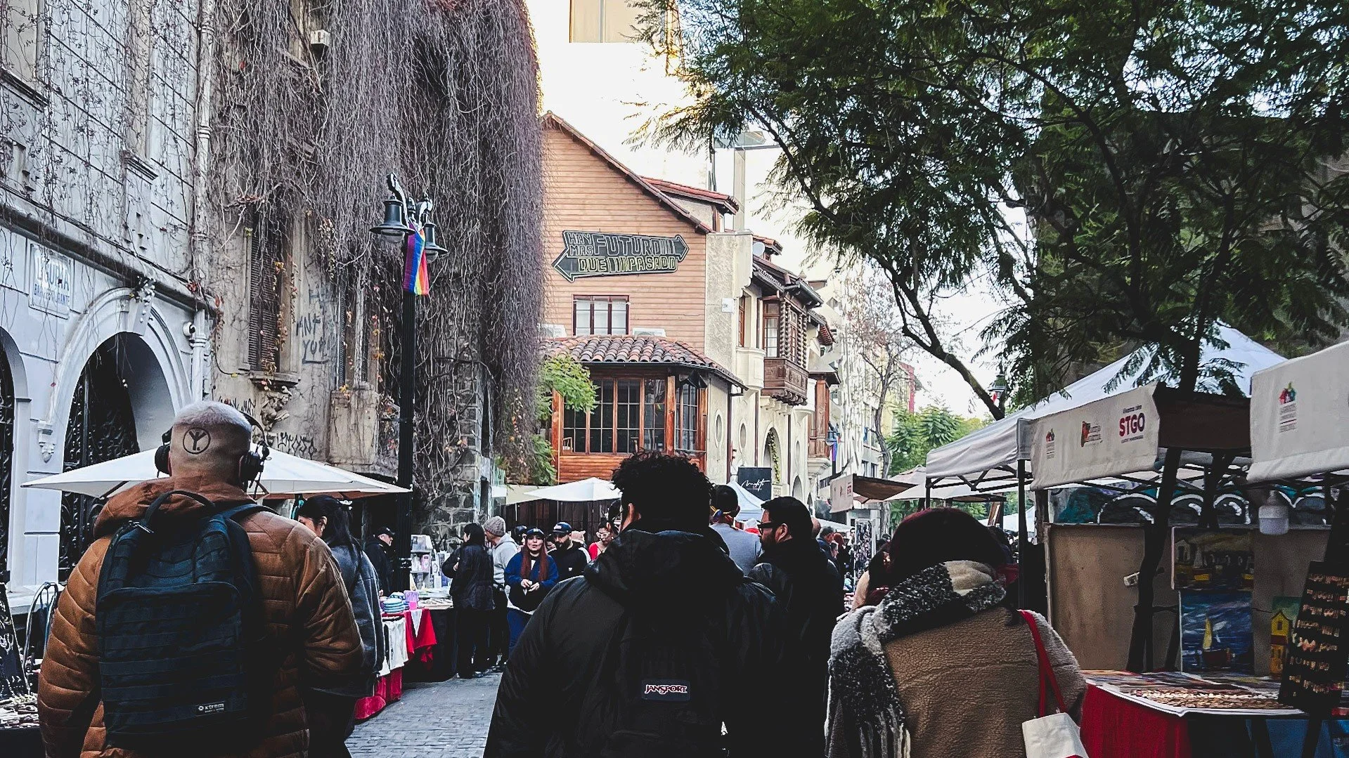
Central / Bellas Artes / Lastarria / Baquedano
Parque Forestal Loop (✅)
Best for: Easy runs • steady efforts/tempo • repeat loops • controlled (lower-speed) intervals
What to expect: Long, linear downtown park with high foot traffic (locals + tourists)
Route format: Loop
Route notes:
- North side: wider and straighter paths — best for repeats/interval-style efforts (though all-out sprinting will be harder on the dirt).
- South side: more meandering paths through the park — better for easy running and steady efforts.
Practical distance options:
- 1.5–2 km: compact loop (using 1–2 sections)
- 3–4 km: 2 compact loops or a fuller loop around more of the park
- 6–8 km+: stack loops, or extend along the river into Balmaceda for longer runs
- Note: You can keep looping to add distance, but it can start to feel repetitive.
Surface: Mostly compacted dirt (with some concrete sidewalks)
Interruptions:
- Crosswalks: medium (but you can loop within sections to minimize stops)
- Crowds: medium–high (best early morning if you want space)
Closest Metro: Baquedano (Lines 1/5) • Bellas Artes (Line 5)
My notes:
- Even when it’s busy, most people hang out on the grass rather than blocking the paths, so I don’t experience too many interruptions actually. The dense trees also make it feel surprisingly shaded and quite enjoyable scenery-wise – like an “urban forest,” true to the name!
- To me, the vibe feels more secure towards the east side of the park (Bellas Artes Museum and east).
Wide dirt paths on the north side of Parque Forestal, great for faster speeds and intervals.
Mapocho River Corridor (Linked-Parks Route) (✅)
Best for: Longer runs • building distance • run-commutes • flexible routes
What to expect: A string of long, linear parks and riverside paths along the Mapocho — great for building distance, but with city crossings.
Route format: Out-and-back or point-to-point
Route notes:
- Links the parks and paths lining the Mapocho River, starting around Parque Forestal/Balmaceda and continuing east toward Providencia, Las Condes, and beyond.
- Very flexible — you can keep extending the route as far as you want depending on distance goals.
Practical distance options:
- 4–5 km (point-to-point): Parque Forestal → Parque Balmaceda → riverside path toward Costanera Center
- 8–10 km (out-and-back): Same route, then turn around
- 10 km+ (point-to-point or out-and-back): Forestal → Balmaceda → toward Costanera Center → Parque Bicentenario (and beyond)
Surface: Compacted dirt inside parks + concrete sidewalks/paths between sections
Interruptions:
- Crosswalks: medium–high (smaller crossings between sections, larger roads between parks)
- Crowds: medium–high (Forestal and major crossings can be especially busy)
Closest Metro: Baquedano (Lines 1/5) • Bellas Artes (Line 5) • Salvador (Line 1) • Tobalaba (Line 1)
My notes:
- Because this route links separate parks, you will likely stop at crosswalks, and sometimes across large, busy roads.
- Construction near Baquedano Metro and Parque Balmaceda may require weaving between park paths and main streets.
- For me, this works great as a run-commute from downtown Santiago to the eastern neighborhoods.
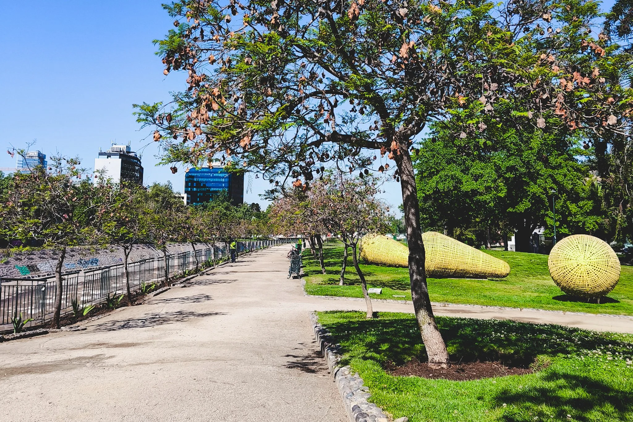
One stretch of the Mapocho river corridor (east of Parque Balmaceda, near Costanera Center), with art sculptures.
Providencia / Barrio Italia
Parque Balmaceda (✅)
Best for: Steady efforts/tempo • repeat loops • easy runs
What to expect: Linear riverside park with wider paths and a calmer, more “through-park” feel — less of a social hangout spot than Forestal.
Route format: Loop
Route notes:
- Location note: Balmaceda is technically in Providencia, but it begins immediately east of Parque Forestal and connects seamlessly along the river.
- Similar length to Parque Forestal, but with fewer crosswalks (just 1) and generally fewer crowds.
- Great for uninterrupted steady efforts (like tempo runs) because it’s easier to settle into rhythm.
Practical distance options:
- 2 km: loop the largest section
- 2.5 km: loop the full park
- 4–5 km: stack loops
- 6–8 km+: stack loops, or extend along the river west into Forestal or east toward Las Condes for longer runs
Surface: Compacted dirt
Interruptions:
- Crosswalks: low
- Crowds: low–medium (usually busier in the afternoon)
Closest Metro: Baquedano (Lines 1/5) • Salvador (Line 1)
My notes:
- Balmaceda is bordered by big avenues, so it feels more like a “connector” park than a neighborhood gathering spot.
- Still a lovely, tree-filled route with wide paths and enough separation from traffic to feel like a mini escape.
- One of my favorites for running — crowds are usually low and it’s easy to lock into a steady rhythm.
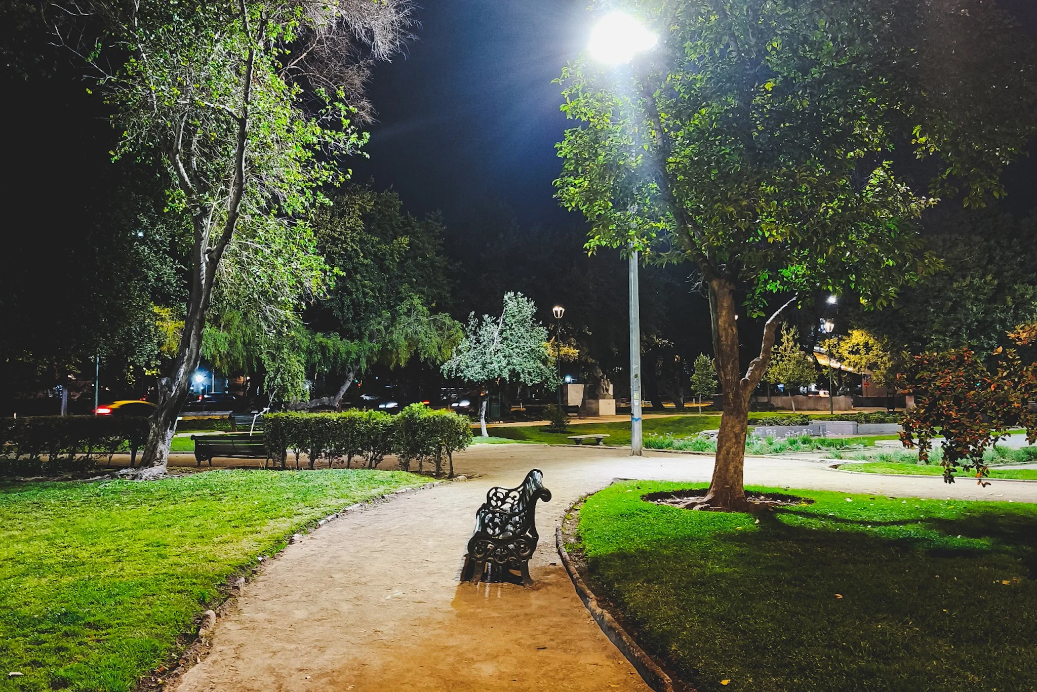
Parque Balmaceda at night. More low-key park for steady efforts, but I wouldn’t go at night without a buddy.
Parque Bustamante Loop (✅)
Best for: Easy runs • repeat loops • low-pressure runs
What to expect: Lively urban park with lots of local energy — people jogging, hanging out, and working out. Dirt paths are popular with runners, plus there are calisthenics bars and a big skatepark.
Route format: Loop
Route notes:
- The park is split into 3 sections, each with its own loop.
- You can cross at crosswalks to link sections, or stay within one section to minimize stops.
- Great when you don’t mind sharing space — it’s more a community park than quiet running route.
Practical distance options:
- 1 km: loop the largest section
- 1.5–2 km: loop the full park (all sections)
- 3–5 km: stack loops
- 6–8 km+: extend by heading north to connect with the parks/paths along the river (requires crossing a larger avenue)
- Note: You can keep looping to add distance, but it can start to feel repetitive.
Surface: Mostly compacted dirt (with some concrete sidewalks)
Interruptions:
- Crosswalks: medium (but you can loop within sections to minimize stops)
- Crowds: medium–high (best early AM if you want space)
Closest Metro: Baquedano (Lines 1/5) • Parque Bustamante (Line 5)
My notes:
- In terms of neighborhood energy, this is the park on my list with the most of it — there's music, socializing, and exercise happening all day.
- On some afternoons you’ll even see organized group workouts.
- The skatepark section is a fun bonus — it’s genuinely entertaining to run past and watch people shred.
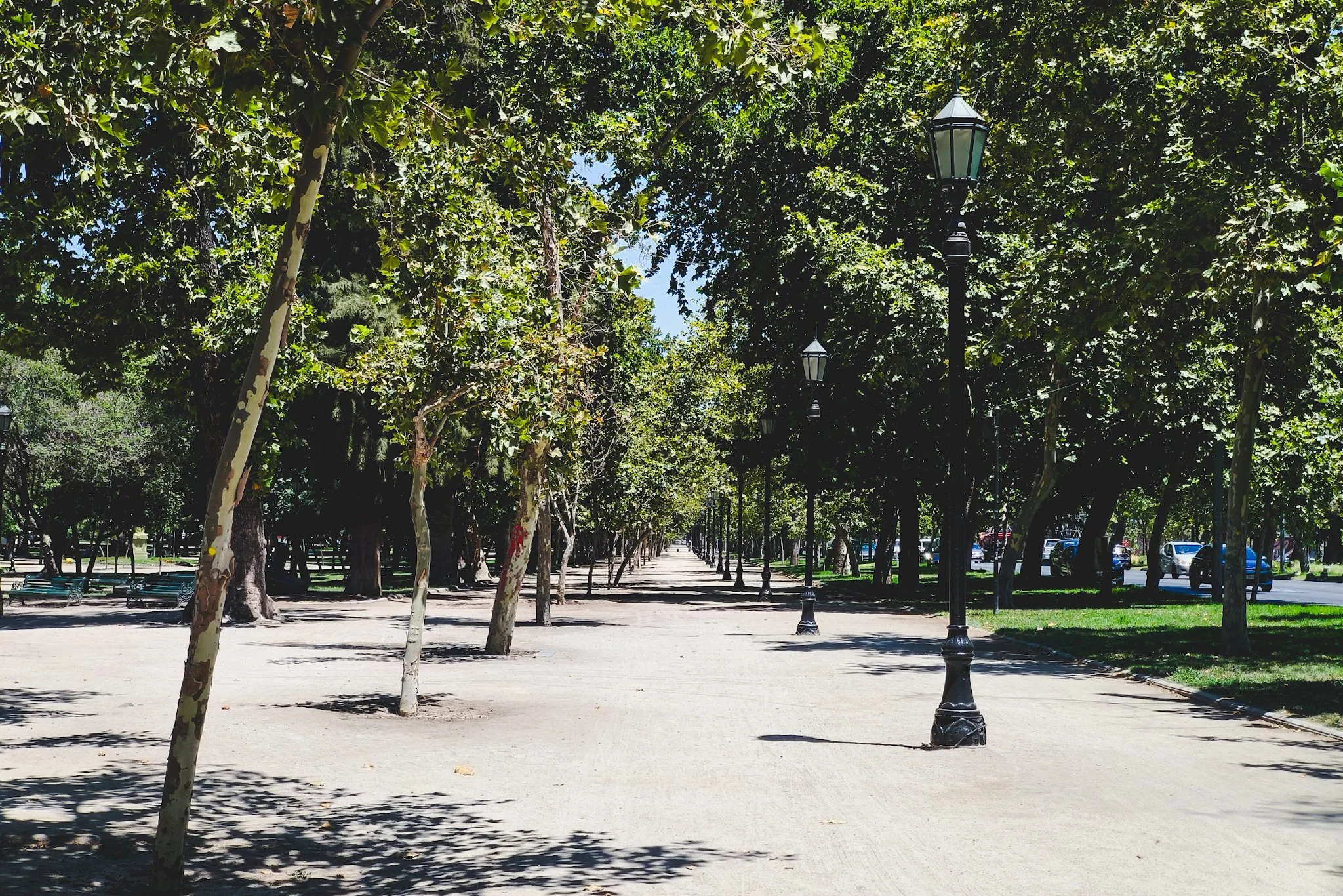
A stretch of Parque Bustamante with a straight path. This is a rare-ish people-free moment since the park and paths are usually lively.
Cross-Neighborhoods
San Cristóbal Hill via Sendero Zorro Vidal (✅)
Best for: Hill training • strength days • climbing efforts
What to expect: A Santiago landmark inside the massive Metropolitan Park complex. This is a steady climb (not rolling hills), with views opening up as you go — you don’t have to reach the top to get rewarding scenery of the city and surrounding Andes Mountains.
Route format: Out-and-back (climb up, return the same way)
Route notes:
- Big climb: This is continuous uphill rather than rolling terrain — expect a sustained effort.
- Full route benchmark: 3.5 km round trip (2.2 miles) with ~230 m elevation gain (754 ft) to the top viewpoint.
- Views payoff early: You’ll start getting great city/Andes views before reaching the summit.
Practical distance options:
- 1–2 km: climb as far as you like, then descend
- 2 km: climb to the top, then take the cable car down
- 3–4 km: full out-and-back to the top viewpoint
- 5–8 km+: extend by adding extra paths inside the park complex after the climb
Surface: Mix of paved park roads and dirt/gravel paths (varies by route choice)
Interruptions:
- Crosswalks: low (once you’re in the park; getting to the entrance involves city streets)
- Crowds: medium–high (best early AM if you want space)
Closest Metro: Baquedano (Lines 1/5) — then ~1 km walk through Bellavista to the entrance
My notes:
- This feels like a “proper hike” effort, but a very rewarding one.
- It’s an iconic Santiago experience, and it’s easy to turn into a run + explore day afterward.
- There’s a lot more inside the park complex beyond the main climb (including a botanical garden and a Japanese garden).
- Note that this is the route up through Sendero Zorro Vidal — there are entrances in Providencia as well, but I personally have not used them. I will update when I do.
A wide paved road on the top of the hill. I don't have a pic of the climb to the top since I'm usually dying a bit when I am going up xD but I will take one next time I go.
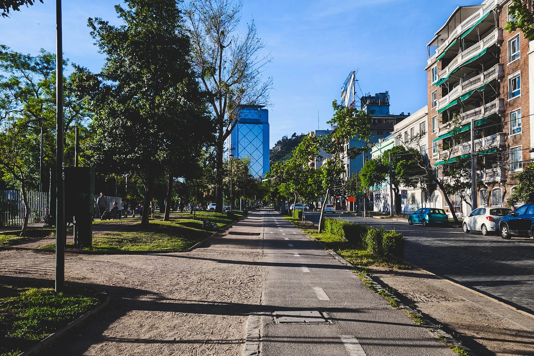
Sunday CicloRecreoVía (✅)
Best for: Long runs • steady efforts/tempo • intervals (time-based or landmark-based)
What to expect: Major avenues closed to cars every Sunday, turning the city into a giant open-streets route shared by cyclists, skaters, runners, walkers, and families. The hours are typically 09:00–14:00 — for route maps and updates, check the official CicloRecreoVía website before you go.
Route format: Point-to-point or out-and-back
Route notes:
- Huge network: 23+ km of open streets total — you can build almost any distance you want.
- Main corridors: Avenida Andrés Bello / Mapocho corridor (north; long, straight stretches) and Avenida Irarrázaval (south; Ñuñoa near Barrio Italia), plus smaller connecting segments.
- Intervals tip: Use time-based reps (e.g., 1–3 minutes hard / easy) instead of distance reps, since the corridor is shared and conditions change.
Practical distance options:
- 5–8 km: pick one direction, run to a landmark, turn around (easy out-and-back)
- 10–16 km: longer out-and-back on a main stretch (great for steady efforts)
- 18–30 km: classic long-run day — go point-to-point if you have a return plan, or keep it simple with an out-and-back
- Intervals: time-based reps (e.g., 1–3 minutes hard / easy) work best here
Surface: Paved roads (asphalt/concrete)
Interruptions:
- Crosswalks/stops: low–medium (some intersections are fully closed; others may still require attention or waiting for light changes)
- Crowds: medium–high (gets busier later in the morning)
Closest Metro: Baquedano (Lines 1/5 — north hub) • Salvador (Line 1 — north) • Los Leones (Line 1 — north/east) • Irarrázaval (Lines 3/5 — south hub) • Ñuñoa (Lines 3/6 — south)
My notes:
- I absolutely love that Santiago has this every Sunday — running on wide car-free roads is such a special treat, and even better to be able to do it every week.
- It’s my go-to for weekend long runs.
- If you head east, you get steady Andes views on clear days.

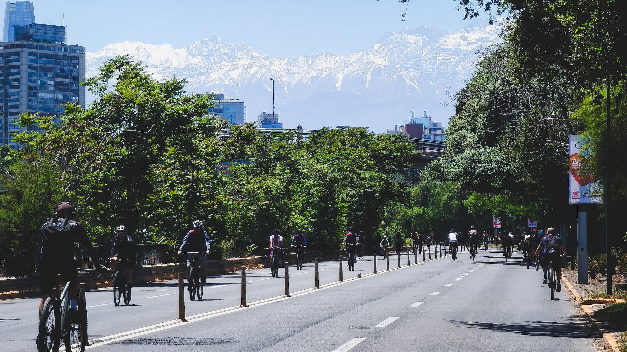
Car-free Avenida Irarrázaval during CicloRecreoVía with the Andes Mountains in the background. See the hero image at the top of the post for the one on Avenida Andrés Bello.
Las Condes / Vitacura (On My List 🧭)
If you’re staying further northeast into Vitacura / Las Condes, these routes are on my list based on walking through them, mapping, and local recommendations — I’ll update with firsthand notes after actually running them.
Parque Araucano (🧭)
Best for: Easy runs • steady efforts • relaxed loops
What to expect: Large, modern park in Las Condes (next to a big shopping center) with wide paths, open lawns, and a calmer feel compared to central Santiago parks.
Route format: Loop
Route notes:
- Wide paths and open lawns make this an easy place to settle into a relaxed rhythm.
- Optional extension: cross the skybridge into Parque Juan Pablo II to add distance.
- Self-contained park setting — minimal city-street interruptions compared to downtown routes.
Practical distance options:
- 2–3 km: park loop
- 3–4 km: loop crossing skybridge into Parque Juan Pablo II
- 5 km+: stack loops
Surface: Dirt paths + brick paths and plazas
Interruptions:
- Crosswalks: low (self-contained park)
- Crowds: low–medium (families and walkers, especially weekends)
Closest Metro: Manquehue (Line 1)
My notes:
- I’ve visited a number of times but haven’t run here yet.
- Based on the layout, it looks ideal for relaxed runs when you want space and greenery without city interruptions.
- It also seems well-suited to harder workouts in the mornings when there are fewer people.
Parque Bicentenario (🧭)
Best for: Easy runs • steady efforts/tempo • longer intervals • scenic loops
What to expect: Scenic, expansive park in Vitacura next to the Mapocho River, with landscaped paths, lagoons, and mountain views — quieter and more polished than central parks.
Route format: Loop
Route notes:
- Landscaped paths and lagoons make this one of the most scenic parks for running in Santiago.
- Feels calmer and more “polished” than central parks — great when you want space and a quieter vibe.
- Can be combined with the Mapocho corridor for longer distances, but that requires crossing big roads.
Practical distance options:
- 1–3 km: smaller loops within sections
- 3–4 km: full park loop
- 5–7 km: stack loops
- 8 km+: combine with parks and paths along the Mapocho (requires crossing big roads)
Surface: Mixed (dirt, paved, and brick) depending on section and path taken
Interruptions:
- Crosswalks: low–none (self-contained park)
- Crowds: low–medium (popular for walking and families)
Closest Metro: No direct station — typically accessed by bus/taxi from Line 1
My notes:
- I’ve visited but haven’t run here yet.
- This park has beautiful scenery of the surrounding hills and a wide, expansive feel.
- It seems ideal for meditative runs, but also harder workouts in a calmer setting.
More Santiago Travel Guides
If you’re interested in taking your running beyond everyday routes, I also wrote about running the Medio Maratón de Viña del Mar 5K as an easy weekend race trip from Santiago.
If you're planning a trip to Santiago, these guides may also help:
Santiago in 1 Day → Ultimate itinerary + map if you only have 1 day
Santiago in 3 days → Practical itinerary to experience Santiago’s landmarks, neighborhoods, and viewpoints
Slow travel in Santiago → My routines, every spots, and real monthly costs as a digital nomad in Santiago
Santiago Neighborhoods, Decoded → Best bases for a walkable trip
One-Bag Packing List for Santiago → Layering system + local add-ons
SCL Airport to Santiago → Time, cost, and safety
Ride the Santiago Metro Like a Local → bip! card, best lines, and tips
Santiago Start Here → Running list of itineraries and guides
Thanks for reading — happy running!
Have a question about this?
Shoot me a message or leave a comment below — I read everything, and I’m always happy to help if I can!