Valparaíso Day Trip from Santiago Without a Car: A Mapped Itinerary
Santiago’s colorful coastal neighbor, Valparaíso, is one of the most popular day trips from the capital — and for good reason. Known for its painted hills, street art, historic ascensores, port views, seafood, and maze-like staircases, the city feels visually dense, energetic, and distinct.
Most people come to Valparaíso to wander Cerro Alegre and Cerro Concepción, and this itinerary is built around making the most of those hills. The area is compact, but the staircases, winding streets, elevation changes, and occasional blocked passages can make it harder than expected to connect the best stops efficiently on your own.
That’s why I built this as a route-first Valparaíso day trip from Santiago: a short port introduction, a historic ascensor ride, a mapped walking route through Cerro Alegre and Cerro Concepción, a seafood lunch, and one flexible afternoon stop, all arranged based on a route I tested myself to minimize unnecessary backtracking. The goal is not to see every part of Valparaíso in one day, but to string together the highlights so you can explore independently without booking a walking tour or constantly wondering where to go next.
If you want more Santiago-based planning in a low-friction way, start with my Santiago travel guide. And if you’re curious how I build routes like this from scratch, I explain my full process in how I plan low-friction travel itineraries.
Quick Plan
Time needed: 1 full day from Santiago, roughly 10–12 hours including bus transit.
Start / end: Santiago bus terminal, ideally Pajaritos.
Best timing: Arrive in Valparaíso around 10:00 AM and return before sunset.
Walking level: Moderate to high. Expect roughly 10,000–16,000 steps with hills, stairs, cobblestones, and uneven sidewalks.
Pace: Moderate, with most of your time spent in Cerro Alegre and Cerro Concepción.
Transportation needed: Intercity bus from Santiago, optional EFE local train, ascensor if running, Uber or EFE back to the bus terminal, and intercity bus back to Santiago.
Best for: Independent travelers who want a full but manageable Valparaíso day trip without booking a walking tour, and who want to see the highlights in an efficient way.
Route logic: This itinerary strings together the main Valparaíso day trip highlights with minimal backtracking: port first, Ascensor El Peral uphill, a mapped Cerro Alegre and Cerro Concepción walking route, seafood lunch, and one flexible afternoon add-on.
Main friction points: Ascensores may be closed, hills are steeper than they look, Google Maps can be imperfect around stairs and alleys, lunch timing matters, and this route is best done in daylight.
Overview Map
Use the overview map first to understand the full flow of the day. Since it’s a long day, I divided the itinerary into 3 parts for digestibility:
Part 1: Arrival to bus terminal, optional Mirador Lobo coastal stop, port area, Ascensor El Peral
Part 2: Cerro Alegre / Cerro Concepción
Part 3: Templeman and Almirante Montt wandering, and the optional final afternoon stops.
You’ll find the detailed route maps for each part are below after the itinerary section, once you know the details of each part.
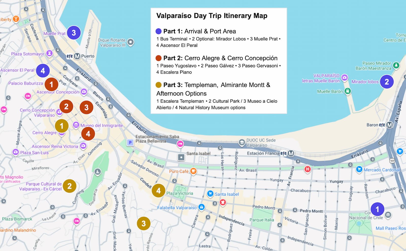
Overview map of the Valparaíso day trip itinerary from Santiago, showing the 3 route sections: arrival and port area, Cerro Alegre and Cerro Concepción, and optional afternoon stops.
A Timed Valparaíso Day Trip Itinerary
Part 1: Arrival & Port Area
Use Route Map Part 1 below for this section.
Take a morning bus from Santiago to Valparaíso.
A bus around 8:30 AM usually gets you in around 10:00 AM, depending on traffic.
This gives you enough time for a full route without making the day feel rushed.
If you’re taking EFE (local transit) to the port area next, you can stop near Mirador Lobos near the Barón station.
Expect calmer port views, wide water views, and possible sea lions farther out in the water.
Add this only if you’re already using EFE. If you’re taking Uber, skip it and go straight to the port area.
Take EFE from Barón to Puerto, or Uber directly to the port area.
Briefly see:
Muelle Prat
Plaza Sotomayor
Navy building
Monumento a los Héroes de Iquique
Keep this section short — you’ll be seeing a lot uphill.
Take Ascensor El Peral up to Paseo Yugoslavo on Cerro Alegre.
This is a low-effort way to go up the hill straight into the core of the itinerary, and it gives you a classic Valparaíso hillside elevator experience.
Plaza Sotomayor in Valparaíso’s historic port area, with the blue Navy building in the background.
Part 2: Cerro Alegre & Cerro Concepción Walking Route
Use Route Map Part 2 below for this section.
This is the core of the itinerary and the part of the day where I’d slow down the most. Cerro Alegre and Cerro Concepción are compact, but this area has the highest concentration of colorful streets, murals, staircases, cafés, historic houses, and panoramic viewpoints.
Explore:
Paseo Yugoslavo: viewpoint over the bay and city; Ascensor El Peral drops you right there.
Palacio Baburizza: early-1900s art nouveau mansion and Fine Arts Museum.
Escalera de la Canción “Latinoamérica”: colorful staircase leading toward the street art lanes, featuring song lyrics.
Pasaje Gálvez: narrow cobblestone alley with murals, cafés, and small shops.
La Puerta Roja: photogenic red-painted door.
Escalera Valparaíso: mural-filled staircase with a slide.
Gálvez intersection with Papudo: colorful connecting street overlooking café patios and alleys.
Paseo Gervasoni: classic viewpoint walk over the ocean and port.
Paseo Atkinson: colorful historic houses with harbor views.
Piano Staircase: piano-key staircase with a Beethoven mural.
Iglesia Luterana de la Santa Cruz: hilltop church near another viewpoint.
These stops are listed in route order; use the map above for the suggested walking path.
Don’t worry if you don’t finish seeing everything before lunch. The area is compact, so you can easily wander a few more streets, viewpoints, or murals afterward before continuing toward Templeman and Almirante Montt.
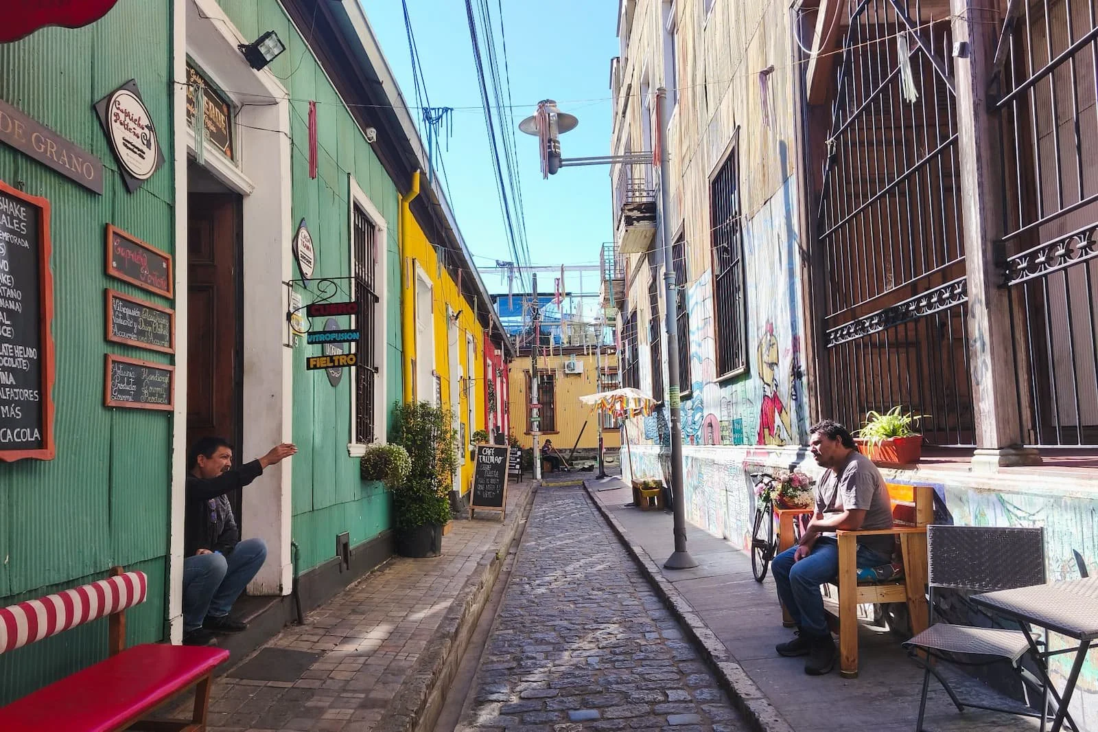
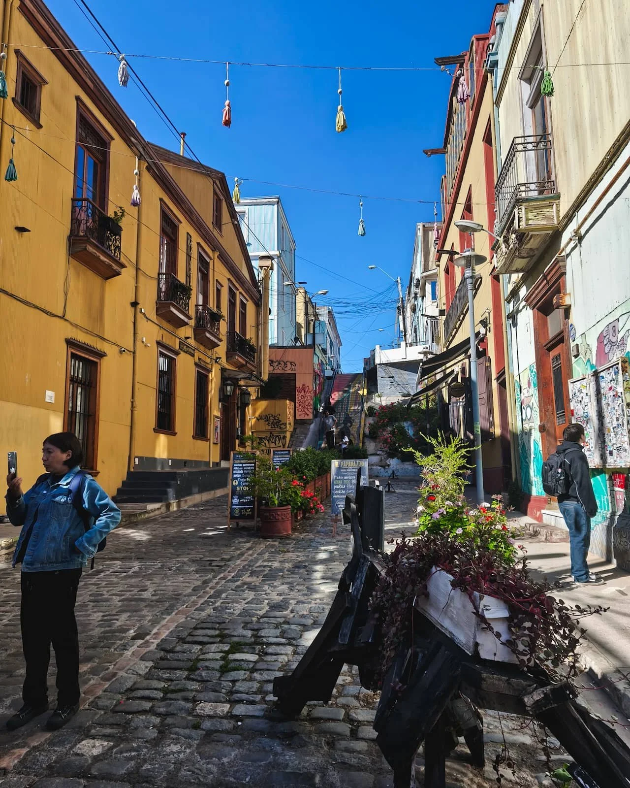
The narrow alleyways of Paseo Gálvez on Cerro Concepción, lined with murals and cafés.
Eat at Tres Peces if you want a popular sustainable seafood spot and don’t mind a possible wait.
Try Cocina Puerto if you want another seafood option that takes reservations.
Tip: I’d skip view restaurants for lunch since you’ll already get plenty of viewpoints while walking.
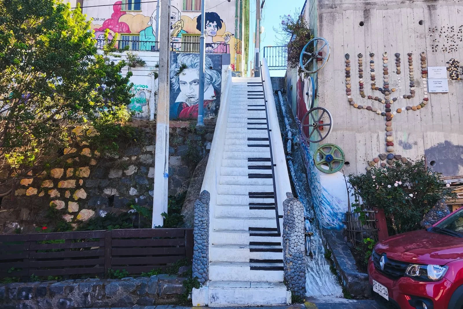
The Piano Staircase on Cerro Concepción.
Part 3: Templeman, Almirante Montt & Optional Final Afternoon Stop
Use Route Map Part 3 below for this section.
Walk Calle Templeman and Escalera Templeman for murals, hillside views, and the “We are not hippies, we are happies” mural.
Then continue toward Plaza San Luis and Almirante Montt, a lively area with cafés and good options for a coffee or pastry break.
Templeman Street is flexible: if you’re eating at Cocina Puerto, you may naturally pass through before lunch. If you’re eating at Tres Peces, save it for after lunch.
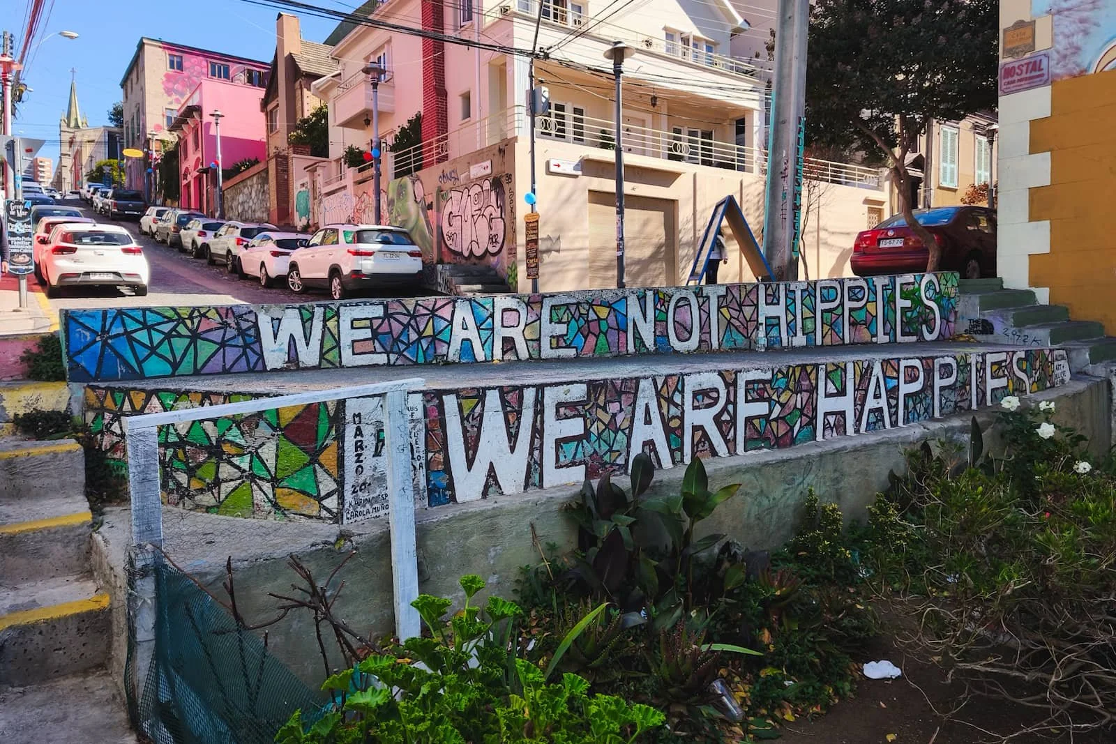
The “We are not Hippies; We are Happies” mural at the top of Escalera Templeman.
Choose one based on your energy, don’t try to force all of them unless you really want to. All are roughly a 30-minute walk through town.
-
Parque Cultural de Valparaíso
[Stop notes]
Best for a spacious, low-pressure ending in a former jail complex turned cultural center. -
Museo a Cielo Abierto / Cerro Bellavista
[Stop notes]
Best for a more local, residential mural walk. Less polished and more spread out than Cerro Alegre and Cerro Concepción. -
Museo de Historia Natural de Valparaíso
[Stop notes]
Best for a calm indoor option focused on the region’s natural history.
The easiest option is Uber back to the bus terminal.
EFE or walking can also work, depending on where you end.
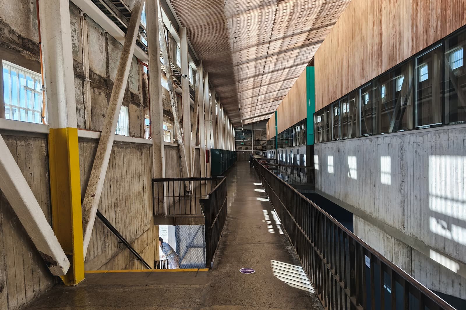
Interior hallways of Parque Cultural de Valparaíso, a former jail turned cultural center.
Example timing
08:30–10:00 Bus from Santiago to Valparaíso → 10:00–10:40 optional Mirador Lobos / Barón stop → 10:40–11:00 EFE to Puerto → 11:00–11:20 port area → 11:20–11:30 Ascensor El Peral → 11:30–13:00 Cerro Alegre + Cerro Concepción → 13:00–14:30 lunch → 14:30–15:00 Templeman Street → 15:00–16:00 Plaza San Luis + Almirante Montt → 16:00–17:30 choose one final stop → 17:30–18:00 return to bus terminal → 18:30–20:00 Bus back to Santiago
Detailed Route Maps
Use these maps for each of the 3 parts of the itinerary.
However, note that they’re meant as suggested routes, not rigid turn-by-turn directions — Valparaíso’s stairs and alleys can require small adjustments.
Route Part 1: Arrival & Port Area
Start: Terminal Rodoviario de Valparaíso
End: Ascensor El Peral
Open arrival route in Google Maps
Open port area route in Google Maps
Route Part 1: Arrival, the port area, and Ascensor El Peral. (Map data © Google)
Route Part 2: Cerro Alegre & Cerro Concepción Walking Route
Start: Paseo Yugoslavo
End: Escalera Templeman / Plaza San Luis
Open route in Google Maps
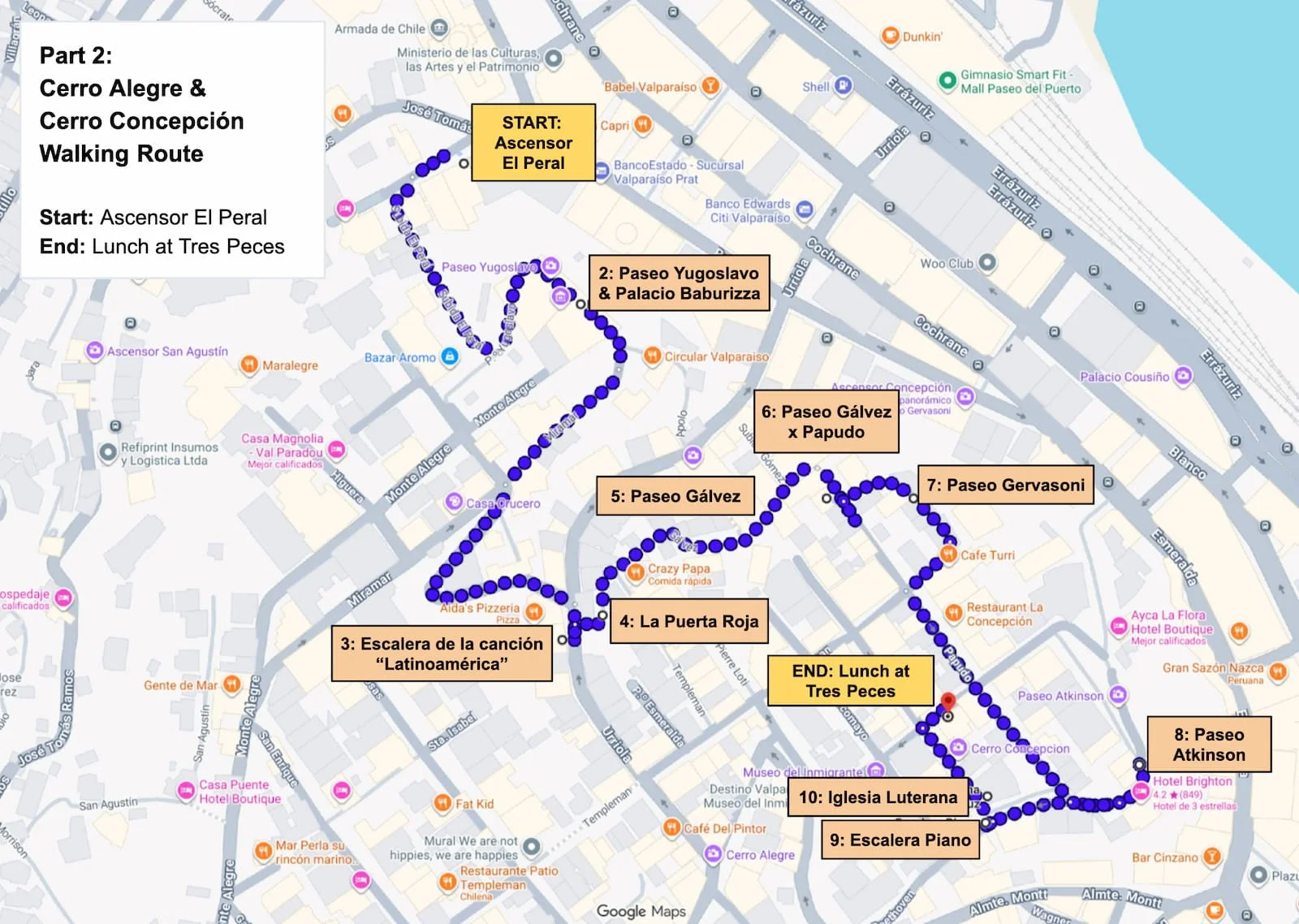
Route Part 2: Cerro Alegre and Cerro Concepción walking route. (Map data © Google)
Route Part 3A: Templeman, Almirante Montt & Parque Cultural
Start: Escalera Templeman / Plaza San Luis
End: Parque Cultural de Valparaíso
Open route in Google Maps
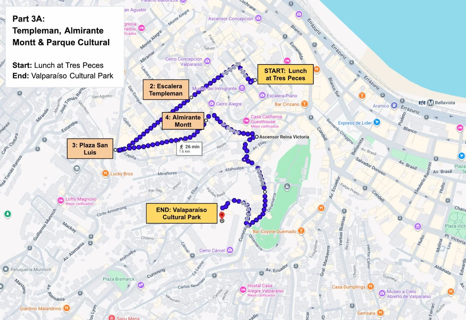
Route Part 3A: Templeman Street, Almirante Montt, and Parque Cultural de Valparaíso. (Map data © Google)
Route Part 3B: Templeman, Almirante Montt & Bellavista / Natural History Museum
Start: Escalera Templeman / Plaza San Luis
End: Museo a Cielo Abierto or Museo de Historia Natural
Open route in Google Maps
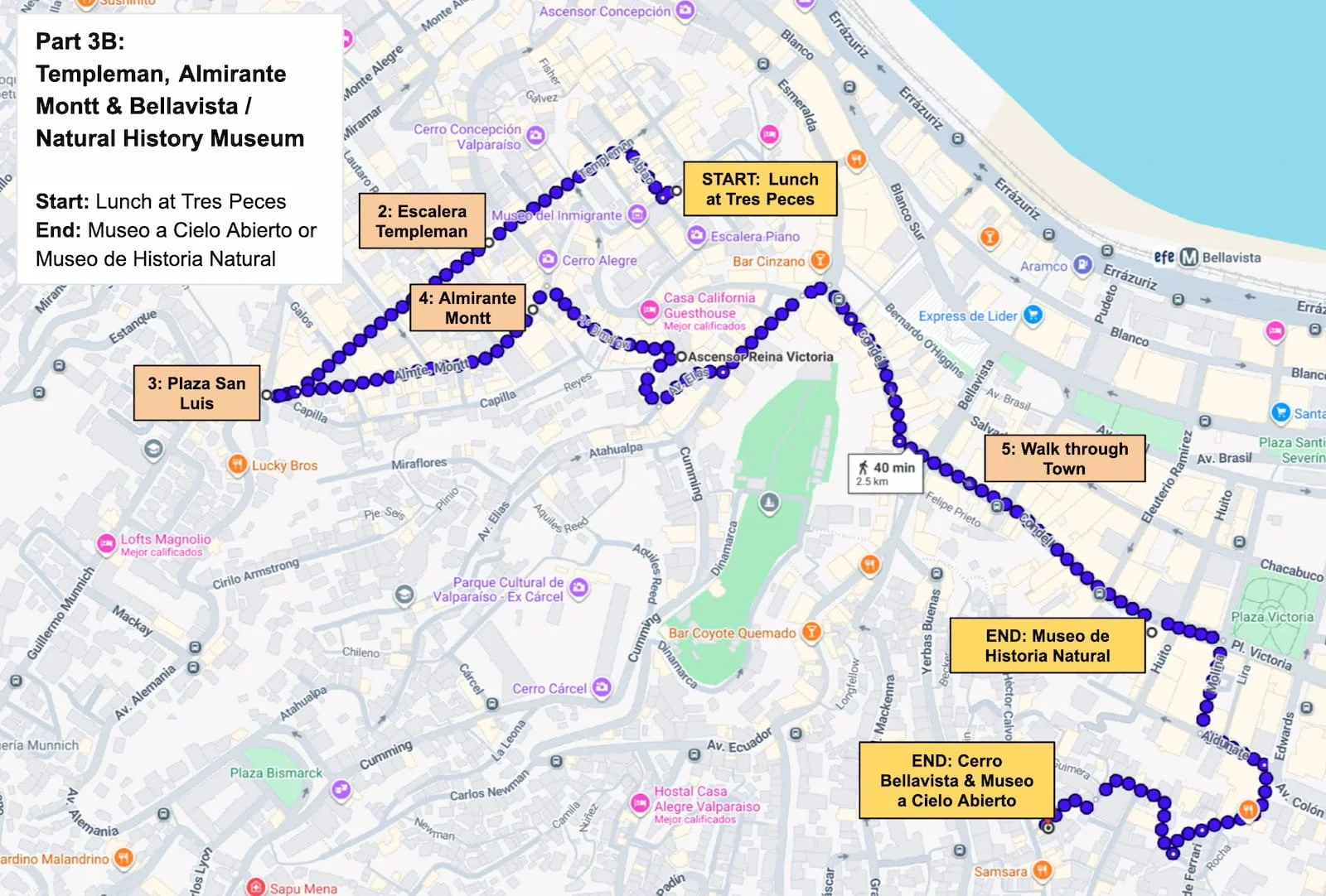
Route Part 3B: Templeman Street, Almirante Montt, Museo a Cielo Abierto, and Museo de Historia Natural. (Map data © Google)
Getting to Valparaíso from Santiago
For a day trip, the simplest option is to take an intercity bus from Santiago to Valparaíso in the morning. A bus around 8:30 AM gives you a comfortable mid-morning arrival, around 10:00 AM, which I found to be good timing for doing this itinerary at a moderate pace.
Tickets are usually reasonably priced, with cheaper fares often around 4,000–6,000 CLP one way, depending on the company, time, and how far in advance you book.
I usually take FlixBus from Santiago Pajaritos to the Terminal Rodoviario de Valparaíso. FlixBus has generally been reliable and clean in my experience. Pajaritos connects directly with the Santiago metro, which makes it a convenient departure point if you’re already comfortable getting around the city (if not, I explain the system in my Santiago metro guide), and it’s much less chaotic than Terminal San Borja in Estación Central.
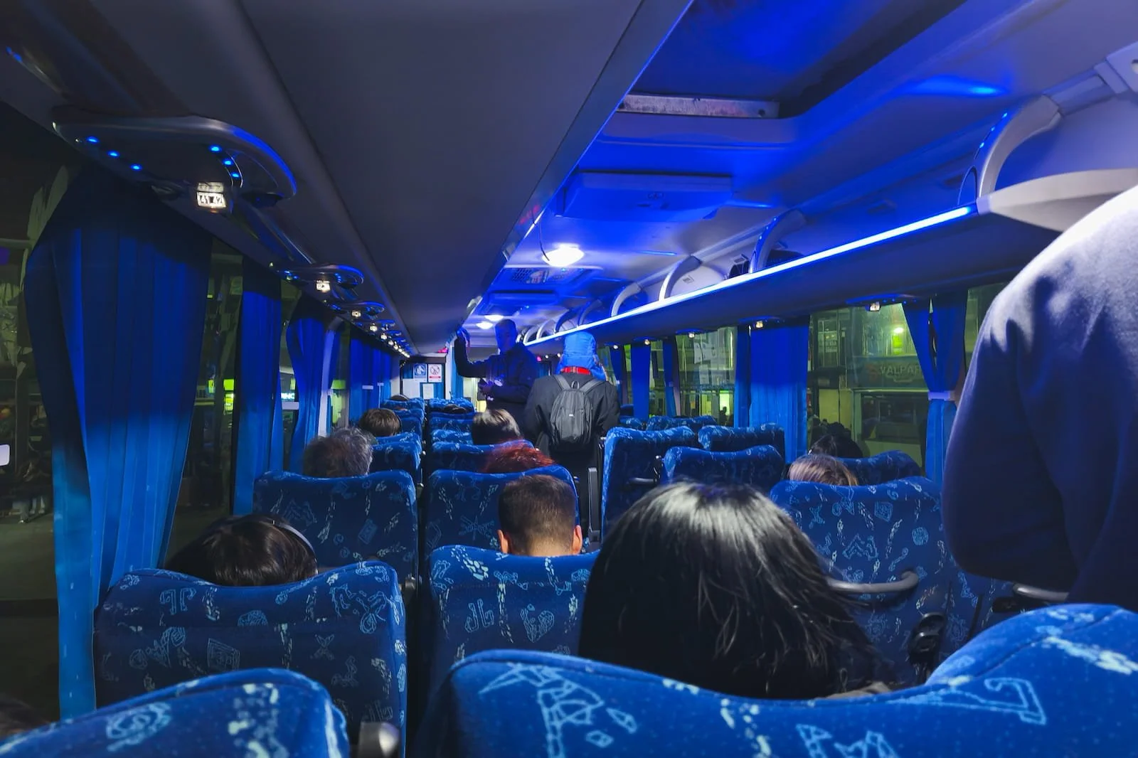
FlixBus on the way back to Santiago from Valparaíso.
Once you arrive at the Valparaíso bus terminal, choose your start based on how much you want to add before reaching the port area.
Smoothest start: take an Uber directly toward the port area.
Coastal add-on: head toward Barón EFE station first if you want to add the optional coastal viewpoint near the water, then take EFE from Barón to Puerto to continue into the port area.
Practical reset: stop at Mall Portal Valparaíso / Jumbo near the terminal first if you need bathrooms, snacks, water, or cash.
Getting Around Valparaíso During the Day
EFE within Valparaíso
If you want to include the coastal stop at Mirador Lobos, the local transit train/metro EFE is useful for connecting you from there to the port area. For this, you would take the EFE from the Barón station (right next to Mirador Lobos) to the Puerto station (right next to the port). The ride is quick, inexpensive, and can be paid by contactless credit card.
That said, I’d only include Mirador Lobos if it fits naturally into your route. If you’re already planning to take EFE, it’s an easy extra stop. If you’re using Uber to get around, I’d skip it and go straight to the port.
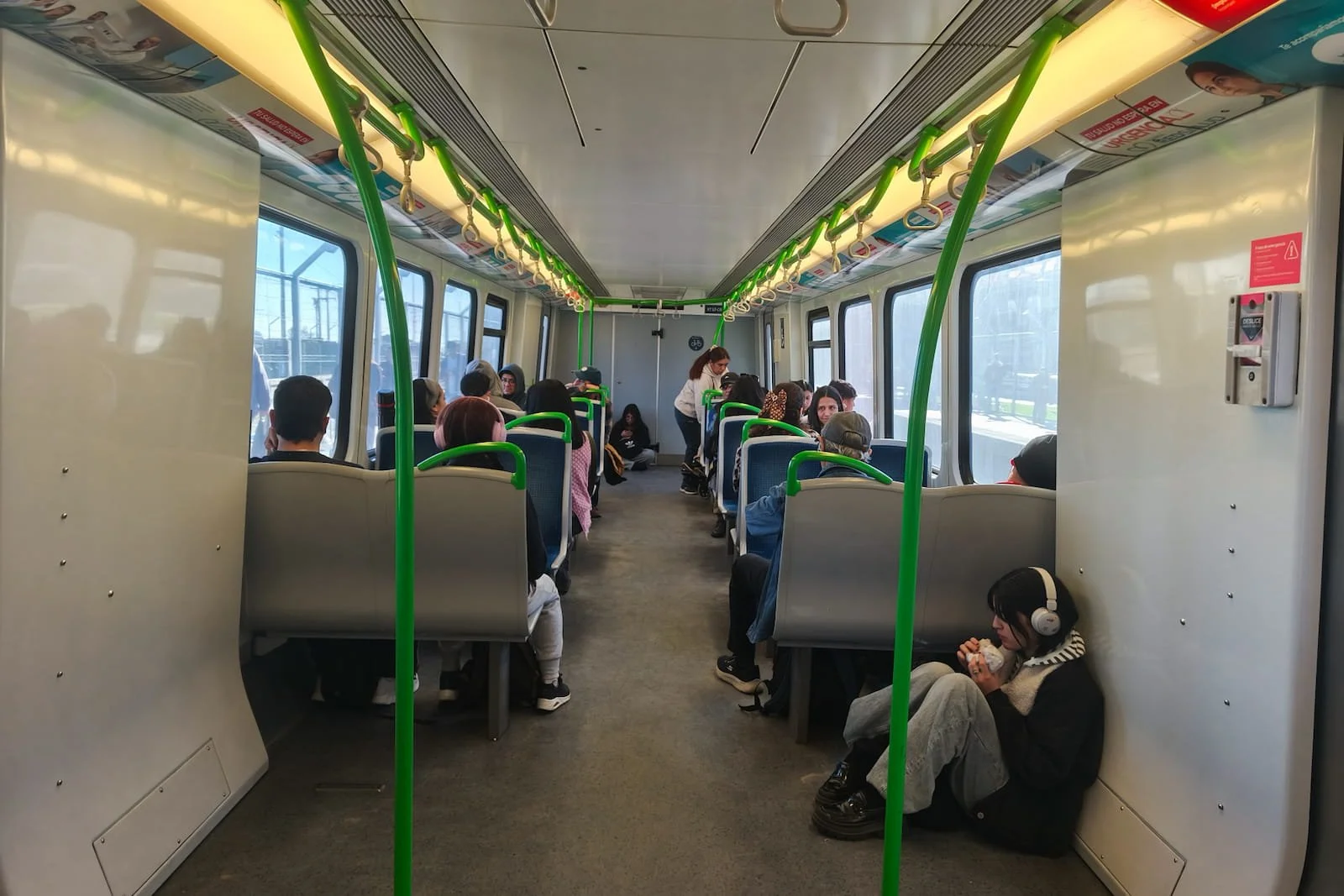
Inside the EFE local train connecting Barón and Puerto stations.
Ascensor El Peral
Ascensor El Peral is the cleanest way to move from the port area up to Cerro Alegre when it’s running. It drops you directly at Paseo Yugoslavo, which is one of the best starting points for the main walking portion of this itinerary. It’s also a fun historical experience to ride this 100+ year old machinery.
That said, Valparaíso’s ascensores can close for maintenance, so it’s worth having a walking backup in mind. If El Peral is closed, the route still works — you’ll just start the hill section with more climbing.
A practical payment note: the lower local fare can be paid by card, but the foreigner fare needs to be paid in cash. Try to bring cash, but there is a Banco Estado ATM nearby if you need it.
Returning to the bus terminal
At the end of the day, I’d take Uber back to the bus terminal. You can take EFE or walk depending on where you end, but after a full day of stairs, hills, and cobblestones, Uber is the lowest-friction option. Try to arrive with some cushion time — the upstairs area at the bus terminal has space to sit while you wait.
My Notes: Mirador Lobos
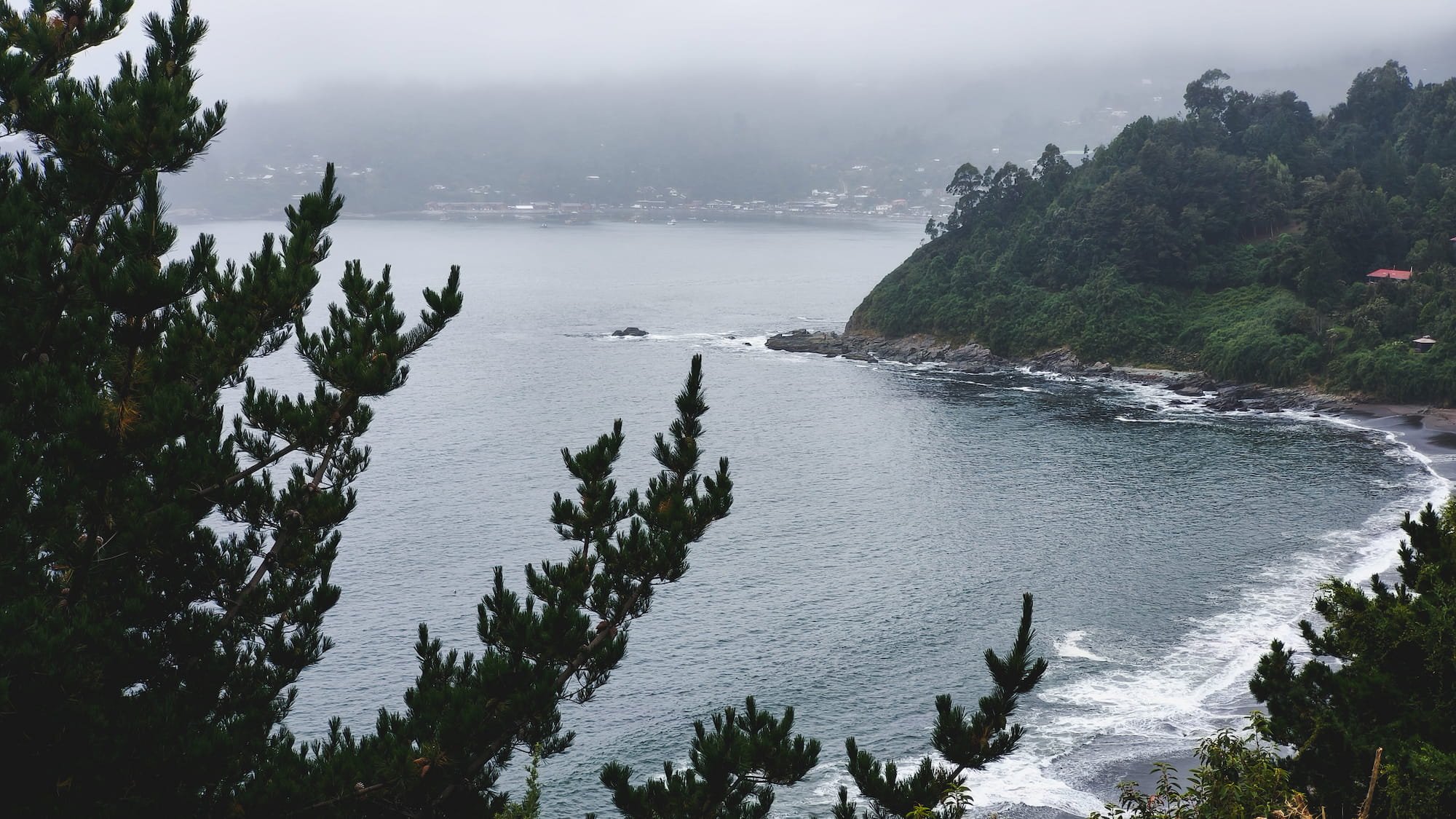
Mirador Lobos is a useful optional stop if you’re already planning to take EFE to the port area, which we did. We went there to see the sea lions, and there were a bunch of them but on a platform a bit farther out in the water, so I wouldn’t treat this as a major wildlife stop.
The better part, to me, was the calmer view of the port and water. It felt much more relaxed than the downtown port area and gave the day a softer start before heading into the busier historic center. But honestly, given you’ll be seeing plenty of views of the water throughout the day, it’s not really worth it to stop by here unless you’re already taking the EFE.
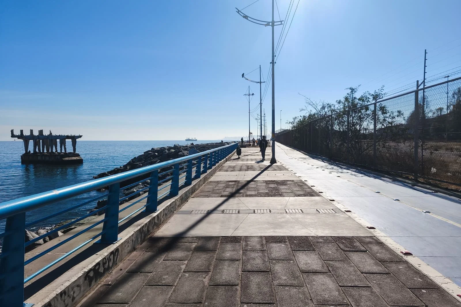
Waterfront promenade at Mirador Lobos. The sea lions are on the platform on the left side.
My Notes: Port Area
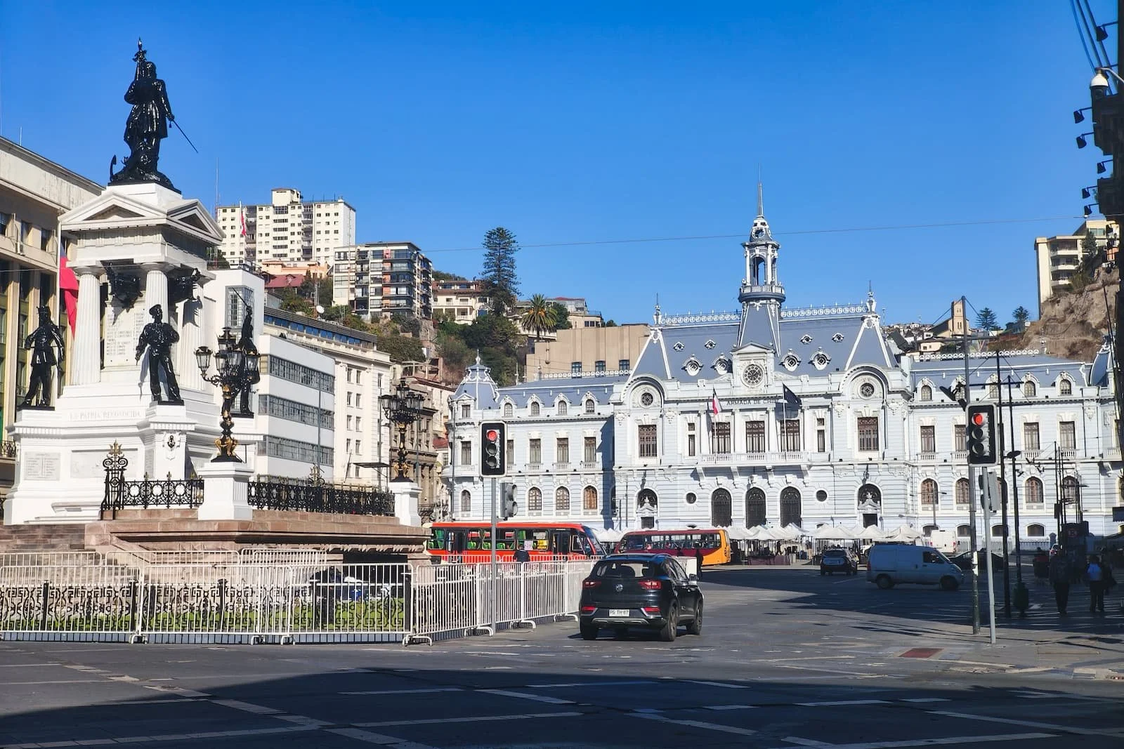
Muelle Prat is a busy port area with views of the harbor, boats, shipping containers, and the city rising into the hills behind it. It’s also where many boat tours start, so the area feels active and very much in use.
Across the road, Plaza Sotomayor is the main civic square and historic center of Valparaíso. The blue Edificio Armada de Chile, headquarters of the Chilean Navy, dominates the plaza. Nearby, the Monumento a los Héroes de Iquique honors the Chilean sailors who fought in the Battle of Iquique during the War of the Pacific. It also serves as a crypt for Admiral Arturo Prat, one of Chile’s national heroes.
Overall, this area is majestic and worth seeing briefly because it gives you a sense of Valparaíso’s historic port identity. But it also feels busy, chaotic, and less relaxing to wander than the hills. There isn’t much comfortable seating, and car traffic moves through the plaza, so I’d treat this as a quick first look before heading uphill.
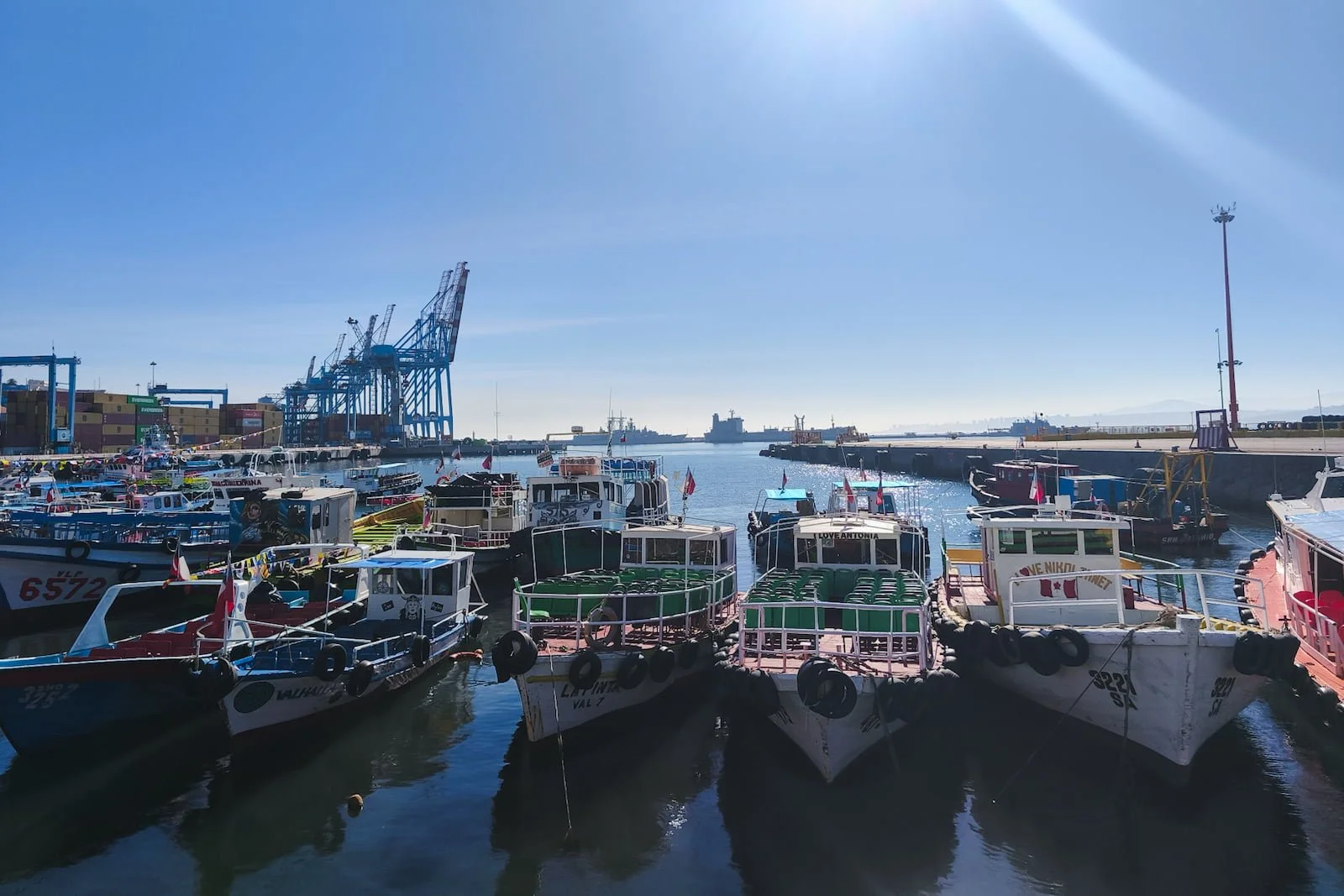
The busy historic port of Muelle Prat.
My Notes: Ascensor El Peral
Basic information
Hours: Every day, 7:00 AM–9:30 PM
Fare: 1,000 CLP for foreigners, cash only; 200 CLP for Chilean nationals, cash or card
Cash tip: There’s a BancoEstado ATM nearby if you need cash
Note: Check the official website for the most updated hours and fare information
Ascensor El Peral is one of Valparaíso’s 16 historic hillside elevators and a National Monument in Chile. Inaugurated in 1902, it connects the port area near Plaza Sotomayor with Cerro Alegre.
The entrance is a little hidden, tucked into a passageway with a small sign, but Google Maps did pinpoint the location accurately for me.
Locals still use it as everyday transportation, but for me, it also felt like a fun historical experience. The machinery has been modernized over time (from steam to electric), but the ride still feels retro. It takes around 3 minutes to go up, and as the elevator slowly climbs, the bay and colorful hills start opening up around you.
This was my first real panoramic view of Valparaíso on the itinerary, so I was busy taking photos while the two locals sitting next to me were completely unfazed and looked at me with mild curiosity.
Even better, Ascensor El Peral is not just scenic and convenient — it drops you right at Paseo Yugoslavo, where your tour of the Cerros start, and which gives you an immediate payoff of hillside and bay views
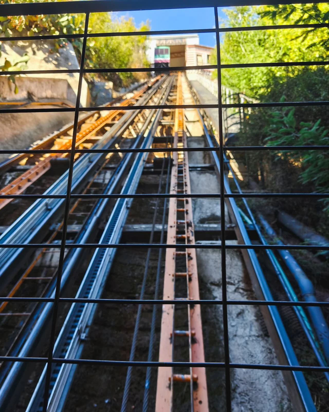
Ascensor El Peral descending toward the port-level station.
My Notes: Cerro Alegre + Cerro Concepción
One of my favorite murals on Cerro Concepción.
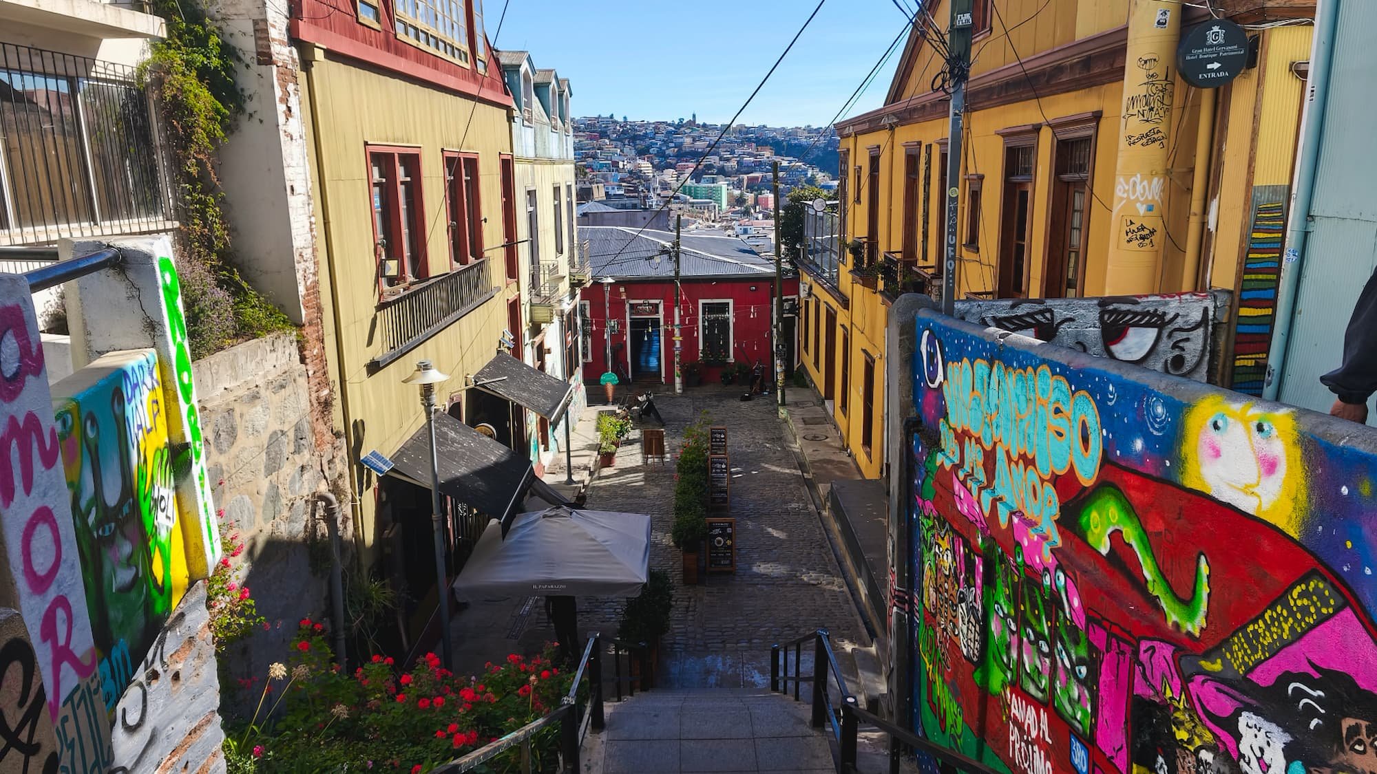
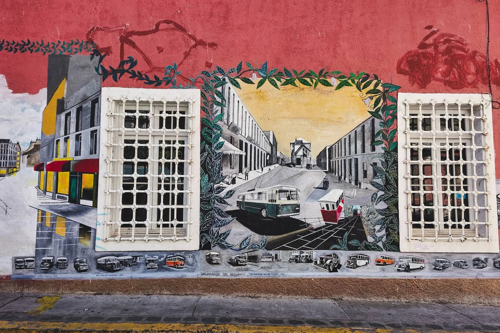
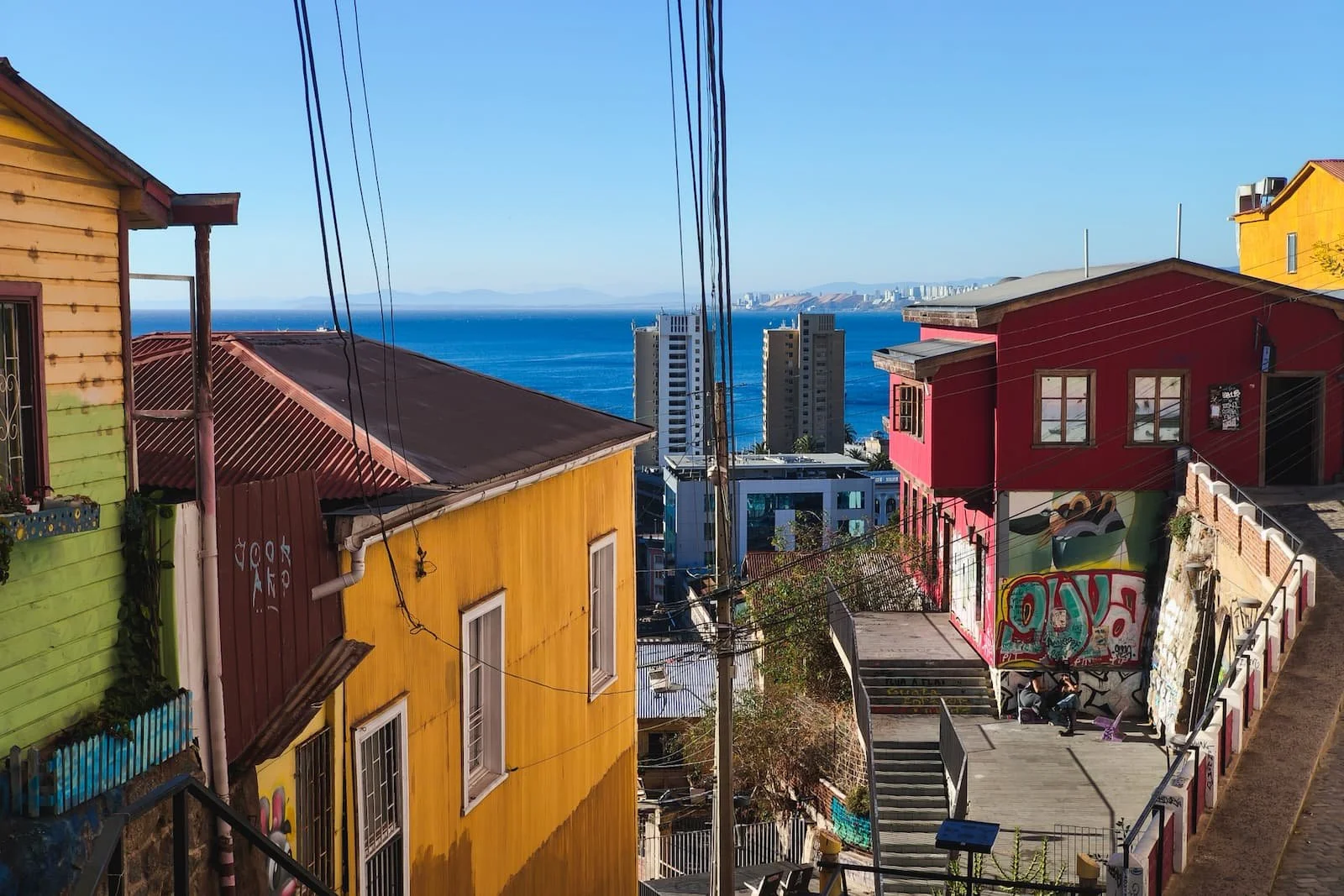
This is the part of Valparaíso most visitors come to see. Cerro Alegre and Cerro Concepción are filled with street art, staircases, viewpoints, colorful houses, old mansions, cafés, and small details that make Valparaíso the bohemian capital of Chile.
The area isn’t huge, but this is where I’d slow down the most. The earlier itinerary lists the stops I think are most worthwhile, including art-filled streets like Pasaje Gálvez, panoramic viewpoints like Paseo Gervasoni, and popular photo spots like La Puerta Roja and the Piano Staircase.
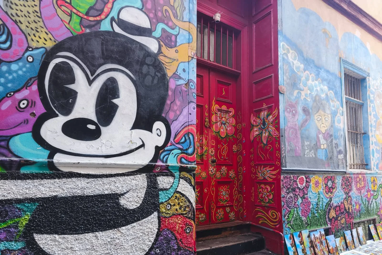
La Puerta Roja, one of the most photographed corners in Cerro Concepción.
Pasaje Gálvez is one of my favorite parts. The narrow cobblestone alley, street art, cafés, craft market, musicians, and stairs all flow together in a way that feels very Valparaíso.
Near the beginning of this section, Escalera Valparaíso is not just stairs, but also a slide. It definitely brought out my inner child to slide down it, but watch out: it goes fast and can cover your butt in a layer of dust.
Toward the end of Pasaje Gálvez and its intersection with Papudo Street, there’s a cobblestone alley with stairs leading up toward Paseo Gervasoni. Every time I go to Valparaíso, this feels like one of my favorite sections. Cafés and restaurants line the alley, musicians play, and when you climb the stairs, you can look back over the colorful houses, the activity below, and the hills in the distance.
The colorful staircase and café area connecting Pasaje Gálvez and Papudo.
From there, a narrow alleyway brings you onto Paseo Gervasoni, where you immediately get expansive views of the hillside and bay on one side, and Victorian-style houses and flowers on the other. On a sunny day, the water is incredibly blue.
There is a lot more to talk about with this section, but for the sake of not turning it into an essay, I will stop here and let you discover this colorful world yourself.
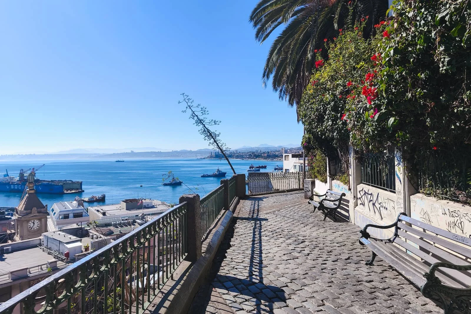
Views of the bay and elegant houses from Paseo Gervasoni.
My Notes: Lunch at Tres Peces or Cocina Puerto
I recommend Tres Peces and Cocina Puerto because they’re both well-rated seafood restaurants in the main Cerro Alegre / Cerro Concepción area. Valparaíso is a port city, so seafood is one of the things worth prioritizing here.
My main lunch tip: don’t over-prioritize a restaurant with a view. (these two don’t have one). You’ll already get plenty of water and port views from the paseos and staircases, so lunch is a better time to focus on food, timing, and convenience.
Tres Peces
Basic information
Hours: Wednesday–Sunday, 12:30 PM–3:30 PM
Price range: $$
Credit card: Yes
Reservations: No
Bathroom: Yes
Note: Check their Instagram page or website for the most updated information
Tres Peces is known for sustainable seafood, with a changing menu that adapts to seasonal catches. The seafood is very fresh, and I especially recommend the parmesan oysters, which seem to be a more regular menu item since I’ve seen them there multiple times.
The main downside is that Tres Peces does not take reservations and it’s popular, so you may need to wait if you arrive at a busy time. It opens at 12:30 PM, so if avoiding a line is important, go closer to opening. We went on a Friday and didn’t have much of a wait, but I wouldn’t count on that every day.

My octopus main dish at Tres Peces. It was both perfectly charred and tender, and served on top a bed of hummus.
Cocina Puerto
Basic information
Hours: Monday and Wednesday–Saturday, 12:30 PM–10:00 PM; Tuesday and Sunday, 12:30 PM–5:00 PM
Price range: $$
Credit card: Yes
Reservations: Yes
Bathroom: Yes
Note: Check their website for the most updated information and reservations
Cocina Puerto is another strong seafood option, and it takes reservations, which makes it a smoother choice if you don’t want to build your day around a lunch line.
It’s farther along Templeman toward Plaza San Luis, so it fits naturally into the direction you’re already walking. But it’s still only about 5 minutes from Tres Peces, so either option works well with this itinerary.
I really loved their curanto porteño, a Valparaíso version of the traditional southern Chilean curanto, which is usually a slow-cooked mix of seafood, meats, potatoes, and other ingredients. It’s quite a feast, both for your stomach and for your eyes. If you go and that sounds good to you, that’s what I’d order.
My Notes: Templeman Street + Plaza San Luis
Templeman Street connects Cerro Alegre and Cerro Concepción and includes Escalera Templeman, a wide staircase with street art and views looking down toward the ocean.
Locals sit on the steps and hang out, and it’s also a good place for visitors to pause for a few minutes. At the top, the staircase has the “We are not hippies, we are happies” mural, which kind of captures the ethos of Valparaíso.
With this itinerary, you’ll be climbing up the steps, so don’t forget to turn around at the top for views back toward the ocean.
Looking down Escalera Templeman toward the ocean.
From there, you can continue toward Plaza San Luis and Almirante Montt. This area has more cafés and neighborhood energy, so it’s a good place to slow down, get coffee, and reset.
One possible stop is Cafetería Entre Cerros, a well-known café for light food, pastries, and coffee. You can try torta amor (“love cake”), a traditional Chilean milhojas-style (thousand-layer) cake with thin crispy layers, manjar, raspberries, and whipped cream.
My Notes: Parque Cultural de Valparaíso
Basic information
Hours: Tuesday–Sunday, 10:00 AM–8:00 PM
Entrance fee: Free
Type: Multi-use cultural center
Bathroom: Yes
Note: Check their website for current hours and exhibitions
Parque Cultural de Valparaíso is a former jail complex turned cultural center, with a large lawn and community spaces.
For me, the most interesting part was seeing the building and interiors, which still clearly resemble a former jail complex, with long hallways lined with small rooms. There are also informational plaques explaining some of the site’s history, including its use as a prison and torture center during the Pinochet dictatorship.
They sometimes have exhibitions, though there wasn’t one when I visited. Even without an exhibition, you can tell it functions as a local gathering place. People were using meeting spaces for different projects, while kids and families were hanging out on the lawn after school.
I wouldn’t call it the most essential stop of the day, and it does take a bit of a walk to get there. But it’s a good late-afternoon option if you want something with a bit of history, more local, spacious, and less visually busy after several hours in the denser hills.
To get there, I’d take Cumming Street. It’s a larger, more direct street and makes the route feel simpler.
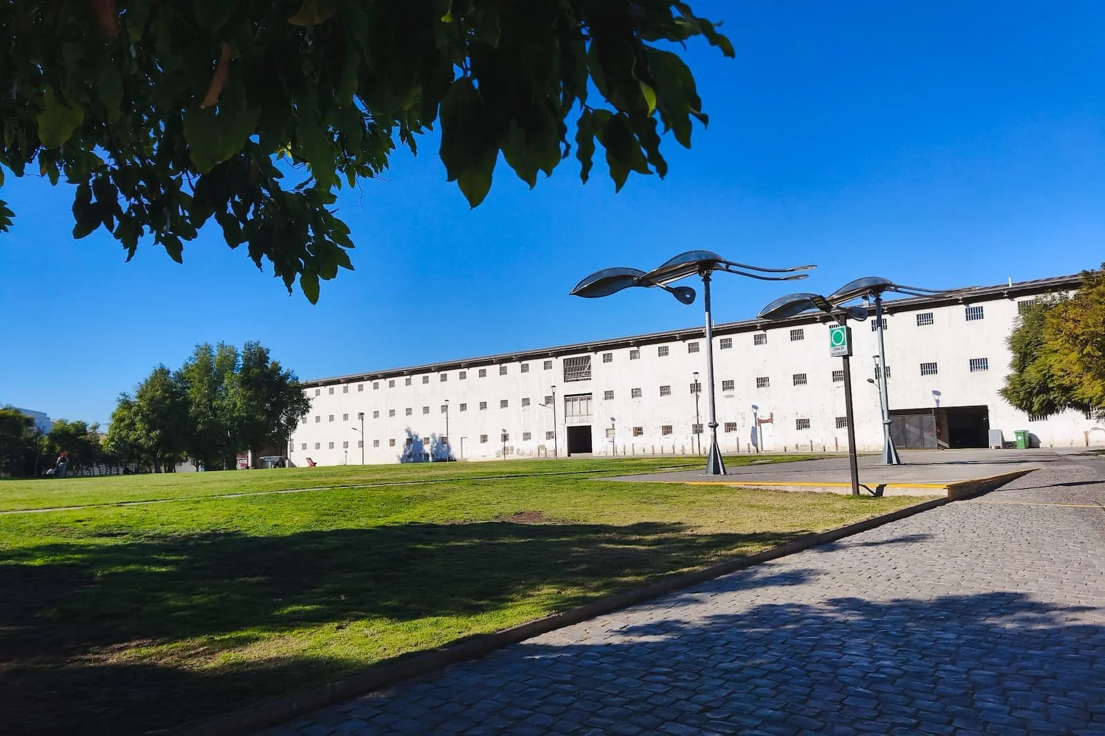
Exterior of Parque Cultural de Valparaíso and the surrounding lawn.
My Notes: Cerro Bellavista + Museo a Cielo Abierto
Basic information
Hours: Anytime
Entrance fee: Free
Type: Open-air museum / street art
Bathroom: No
Note: See its Wikipedia page for a list of the murals
If you still have energy for more murals, Cerro Bellavista and Museo a Cielo Abierto can be a good final add-on.
Opened in 1992, Museo a Cielo Abierto is a permanent, free public art installation on Cerro Bellavista with 20 murals. It was created as a cultural project to bring art into the community, with work by several artists, including Chilean surrealist artist Roberto Matta. The murals also have small informational plaques.
Even though this section also features murals, I’d keep expectations different from Cerro Alegre and Cerro Concepción. Cerro Bellavista is much more local, residential, and spread out. When we were there, we were pretty much the only people looking at the murals, and everyone else seemed to be locals going about their day.
I’d treat this as a loose neighborhood walk rather than a checklist. One highlight to look out for is Mural 10 by Roberto Matta.
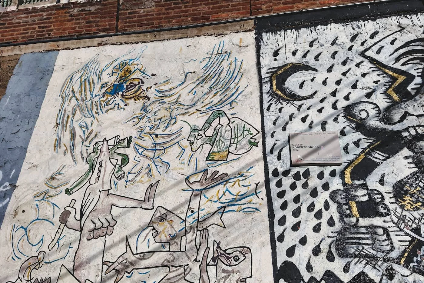
Mural 10 by Roberto Matta, titled “Surrealismo en roca,” in Museo a Cielo Abierto.
My Notes: Museo de Historia Natural de Valparaíso
Basic information
Hours: Tuesday–Friday, 10:00 AM–6:00 PM; Saturday, 11:00 AM–4:00 PM
Entrance fee: Free
Type: Indoor museum
Bathroom: Yes
Note: Check their website for the most updated information
If you want an indoor option, or if you’re ready for a break from hills and stairs, the Museo de Historia Natural de Valparaíso is a good alternative.
It’s free, calm, and gives you a chance to learn more about the flora and fauna of the region. In the style of many excellent free state-run museums in Chile, it isn’t huge, but it feels well-run. There are taxidermy specimens, preserved species, and interactive exhibits that would also be kid-friendly.
When we visited on a weekday afternoon, it was pretty quiet, with only a few other groups there. After a full day of walking, we were actually grateful for a calm indoor place to rest a bit and see something different.
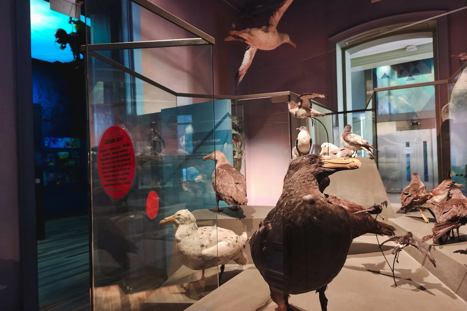
Displays inside the Museo de Historia Natural de Valparaíso.
Logistics: What to Wear and Bring
Most of what I brought for this day fits into my usual one-bag setup: a light layer, water, charger, sunscreen, and a comfortable bag I can carry all day.
If you want the full setup for Santiago and the surrounding areas, I break it down in my one-bag packing list for Santiago. But for this specific Valparaíso day trip, these are the essentials I’d prioritize.
Clothing and footwear
Wear comfortable clothes and good walking shoes. This is a long walking day with constant hills, staircases, cobblestones, and uneven sidewalks, so footwear matters even more here than it would in Santiago.
Valparaíso is also a port city, so you may get ocean breeze, especially earlier in the day or near the waterfront. Since this itinerary starts in the morning and continues through midday, I’d bring a light layer you can easily take on and off as the temperature changes.
Bag and daily essentials
I really recommend a sling bag or crossbody bag that you can wear in front of you. You’ll be walking a lot, stopping for photos, checking directions, and passing through busy areas, so it’s easier to keep things easily accessible and where you can see them.
A portable charger is also very useful for this itinerary. You’ll probably use your phone often (and therefore drain your battery) for navigation, photos, and checking transit details. If you take FlixBus, you may be able to charge with a USB cable on the bus, but in my experience, bus charging can be slow, so I wouldn’t rely on it as your only option.
Bring
Water
A light layer for temperature changes
Sunglasses
Sunscreen for UV protection
Portable charger and/or USB charging cable
Cash for the ascensor
Anti-nausea medication, if you’re sensitive to bus rides
A little extra bag space if you plan to buy souvenirs
For this day, I’d prioritize comfort, security, and keeping your hands free. Valparaíso is not a difficult day trip, but it is a physical one with lots of stairs, uneven streets, and stop-start navigation. So the right bag and shoes make the day feel much smoother.
Logistics: Bathrooms
Bathroom options are somewhat spaced out on this itinerary, and Valparaíso is not a city with convenient public bathrooms. So, it’s worth using them when you see them rather than waiting until you urgently need one.
Here are bathroom options along the itinerary (confirmed / used by yours truly):
On the bus from Santiago
Mall Portal Valparaíso / Jumbo near the bus station
Your lunch restaurant
Cafés on Almirante Montt, if you’re a customer
Parque Cultural de Valparaíso
Museo de Historia Natural de Valparaíso
Logistics: Safety
Valparaíso is very walkable in the main tourist areas, but it’s a busy city that requires attention. Expect hills, staircases, cobblestones, narrow sidewalks, traffic, and some crossings that are less straightforward than they should be.
Tourist core vs. the rest of town
Cerro Alegre and Cerro Concepción usually feel active and comfortable during the day, with plenty of visitors, cafés, restaurants, and people walking around.
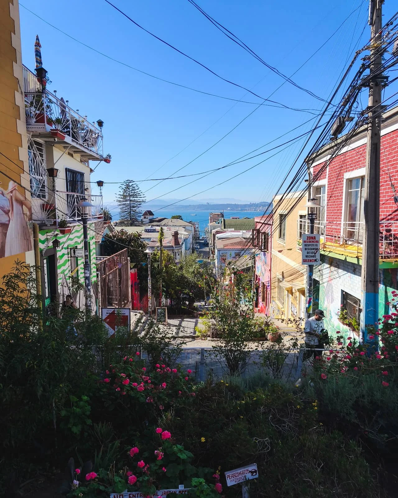
Outside those hills, Valparaíso can feel more mixed: some parts are crowded and chaotic, while others feel quieter with less “safety in numbers.” You may notice this when walking toward the optional afternoon stops.
Walking between areas
When walking toward the optional afternoon stops, I’d stick to larger, more direct streets rather than cutting through smaller side streets or random staircases.
For Parque Cultural de Valparaíso, take Cumming Street. For Museo de Historia Natural or Cerro Bellavista, take Condell.
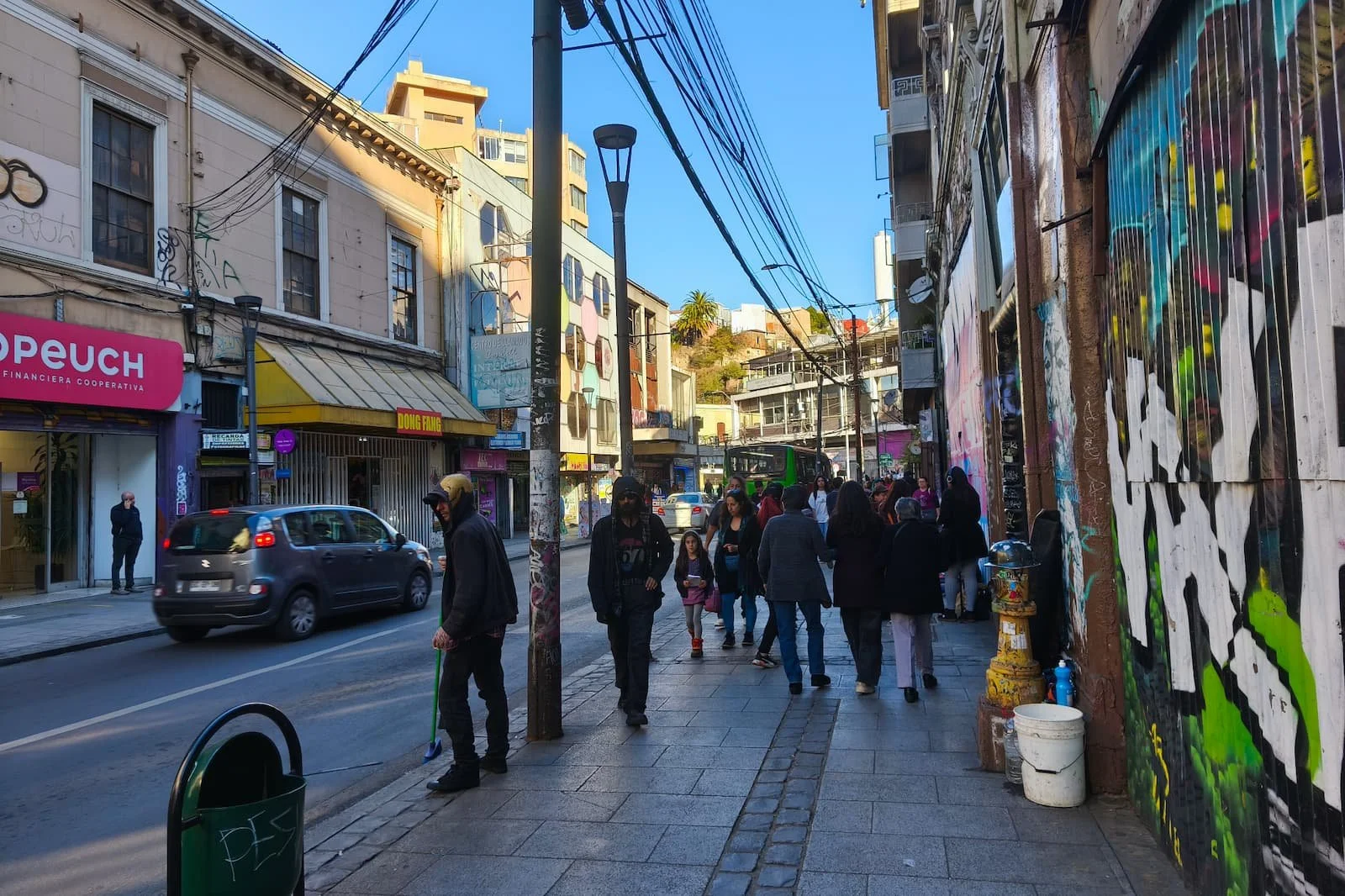
Street scene outside the main tourist hills in Valparaíso, on the way toward the Museo de Historia Natural area.
Port area
The lower port area has some majestic buildings, especially around Plaza Sotomayor, but it feels less relaxing to walk around than the hills.
Be careful with cars, crossings, and narrow pedestrian space near the waterfront. This is one reason I’d keep the port section short and head uphill fairly quickly.
Phone and valuables
Keep your phone and valuables secure, especially while taking photos or navigating.
A sling or crossbody bag works well because you’ll be walking, climbing stairs, stopping often, and pulling out your phone for directions.
End before sunset
I’d treat this as a daylight itinerary. The route intentionally ends before sunset, since Valparaíso can feel less comfortable at night, especially outside the busier restaurant and tourist zones.
For a day trip from Santiago, I’d head back to the bus terminal before dark rather than stretching the day too late.
Modifications
If you want the easiest version
Skip Mirador Lobos, take Uber directly toward the port area, keep the port stop short, and spend most of your time in Cerro Alegre and Cerro Concepción.
End with a café stop in the hills, skip the optional afternoon stops, and take Uber back to the bus terminal.
If you want more street art
Spend extra time in Cerro Alegre and Cerro Concepción, then add Museo a Cielo Abierto in Cerro Bellavista at the end.
I’d only do this if you still have enough energy for another looser walking section. Cerro Bellavista is more spread out and residential than the main tourist hills.
Panoramic hillside views around Museo a Cielo Abierto in Cerro Bellavista.
If you want a calmer ending
Choose Parque Cultural de Valparaíso or Museo de Historia Natural instead of Cerro Bellavista.
Both make the end of the day feel less rushed. Parque Cultural gives you more open space, while the natural history museum gives you a quiet indoor break.
If you’re tired by 4 PM
Call an Uber back to the bus terminal early.
Valparaíso is a lot of stairs, hills, uneven streets, and visual stimulation, and this itinerary still works well even if you skip the final optional stop. The thing to prioritize is the Cerro Alegre and Cerro Concepción stretch.
If you’re spending more than one day in Valparaíso
If you have more time, I’d use this day trip itinerary as your first-day route, then add farther-out areas on a second day.
Good additions include:
Cerro Artillería and the National Maritime Museum
Cerro Playa Ancha, including the Victorian houses around Gran Bretaña Street
La Sebastiana, Pablo Neruda’s Valparaíso house
More time in Cerro Bellavista and Museo a Cielo Abierto
A separate trip by EFE toward Viña del Mar or Concón if you want to explore the coast more
If you don’t make it to La Sebastiana, you could also visit La Chascona in Santiago instead, especially if you’re already following my Santiago 1-day itinerary or Santiago 3-day itinerary.
And if you’re interested in Viña del Mar and Concón, check out myViña del Mar 3-day itinerary, Viña del Mar coastal landmarks walking route, and Concón + Reñaca 1-day itinerary.
If you’re planning a few days in Santiago around this Valparaíso day trip, these guides can help with the rest of your route:
- Santiago in 1 Day → Ultimate full-day walking route to hit the city’s highlights
- Santiago in 3 Days → Landmarks, neighborhoods, viewpoints, markets, and modern Santiago organized into 3 logical days
- What to Pack for Santiago → Carry-on layering system for Santiago’s sun and temperature swings
- Where to Stay in Santiago → Best neighborhoods, safety, and centrality, based on lived experience
- SCL Airport to the City → All transport options, costs, convenience, and local tips
- Getting Around Santiago → How to use the metro like a local, including bip! card, best lines, safety, and rush hour
- Santiago “Start Here” Guide → Running list of Santiago itineraries and guides, updated regularly
If you want another easy no-car day trip from Santiago, this one is a good next option:
- Concha y Toro Winery Day Trip from Santiago → No-car itinerary for visiting the winery by metro, rideshare, and walking
Recap
For a Valparaíso day trip from Santiago, I’d treat the port as a quick introduction, not the main event. The best part of the day is uphill in Cerro Alegre and Cerro Concepción, where the viewpoints, staircases, street art, cafés, and colorful streets are packed close together.
The route is full, but it doesn’t need to be complicated. Take the bus from Santiago, use EFE only if it naturally fits your arrival, ride Ascensor El Peral uphill if it’s running, then give yourself time to wander the main cerros before choosing one optional afternoon stop.
For me, that’s the best way to experience Valparaíso in one day: structured enough that you’re not constantly figuring out where to go next, but flexible enough to leave room for the city’s color, messiness, and small surprises.
Have a question about this Valparaíso day trip?
If you end up doing this trip, let me know in the comments below how it goes! You can also shoot me a message — I read everything, and I’m always happy to help if I can.