
![Olympic National Park: 4-Day Bulleted Itinerary [Updated 2025]](https://images.squarespace-cdn.com/content/v1/59494a70ff7c504114292d44/1629156881778-CRI6BZY5KI83KKE5NPB1/IMG_3432_HEIC.jpg)
Olympic National Park: 4-Day Bulleted Itinerary [Updated 2025]
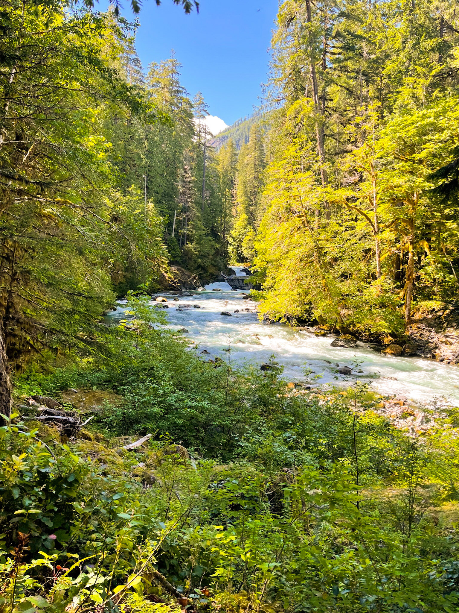
Covering most of Olympic Peninsula, Olympic National Park encompasses almost a million acres and includes vastly distinct ecosystems. All within the park borders, you can find green rolling mountains with grazing deer, the rugged Pacific coastline, extremely lush old-growth temperate rain forests, and mineral hot springs. The amount of diversity in the park was astounding; we almost felt that four days was not enough to cover it all, but we managed to see the highlights in each major area and did a long (21 mile) hike on one of the days (more about that later).
We visited the park in June. As one of the months where the park sees on average fewer days of precipitation (9 days compared to 17 in December) and with an average temperature in the high 60s, it’s one of the best times to visit the park.
Quick overall thoughts
Stop by the Kalaloch area. The restaurant at Kalaloch Lodge has a deck that faces the ocean (and the clam chowder was very good!), and definitely stop by Kalaloch Beach 3 — it is not one of the most popular beaches, but it was a stretch of pristine grey sand that, for a good 10 minutes, we were alone at. I didn’t want to leave.
We didn’t get to visit Hoh Rainforest because when we got there in the morning around 10am, there was already a huge line. According to the park ranger, it being a Saturday and a rare sunny day, there were more people than usual, and crowd control due to COVID meant that they were only letting people in when people come out. [2025 update: Apparently there are still huge lines to enter the park especially on summer weekend, with 1-2 hour waits past the early morning]
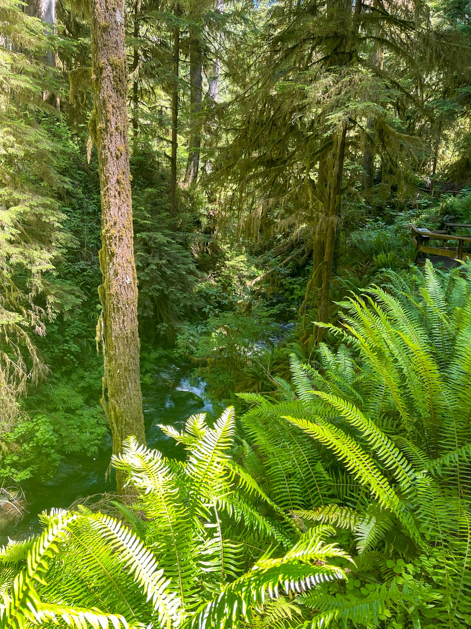
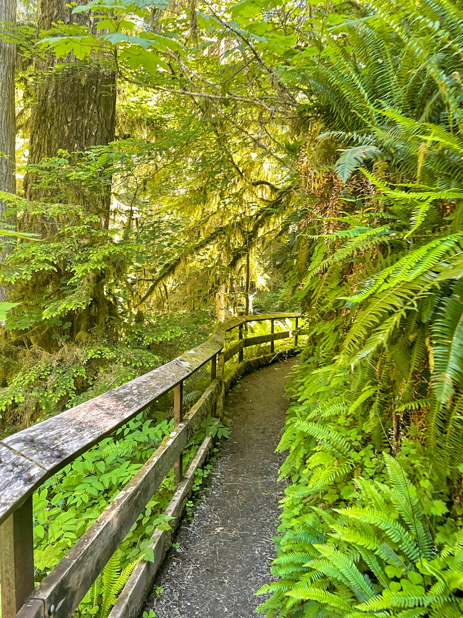
However, we ended up going to Quinalt Rainforest, another temperate in the park but far less crowded. There was a small fee to hike the 0.9 mi trail, but we found it to be rewarding with small number of visitors and the generous number of informative signs posted throughout the trail.
Sunset at Rialto Beach is amazing.
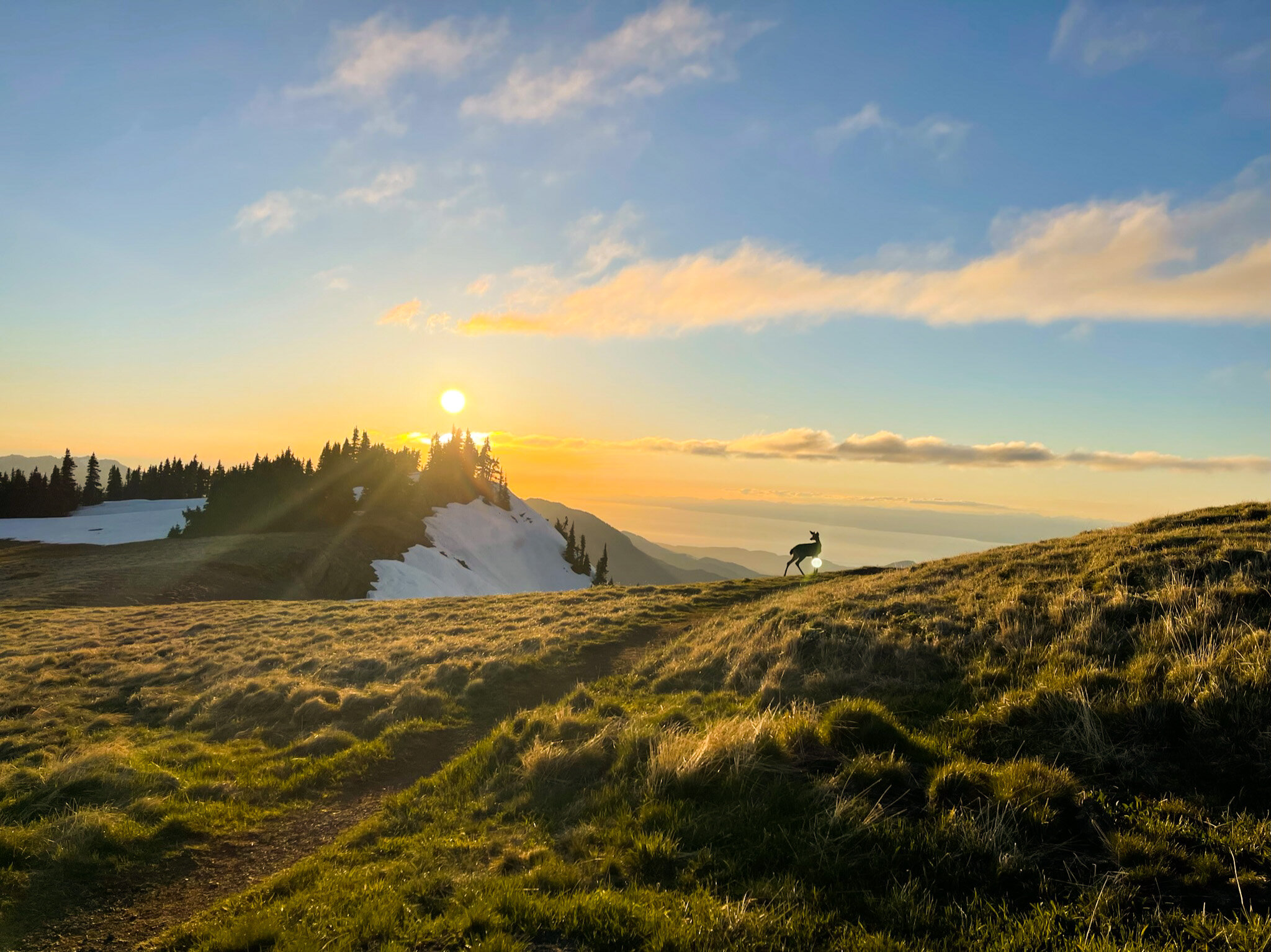
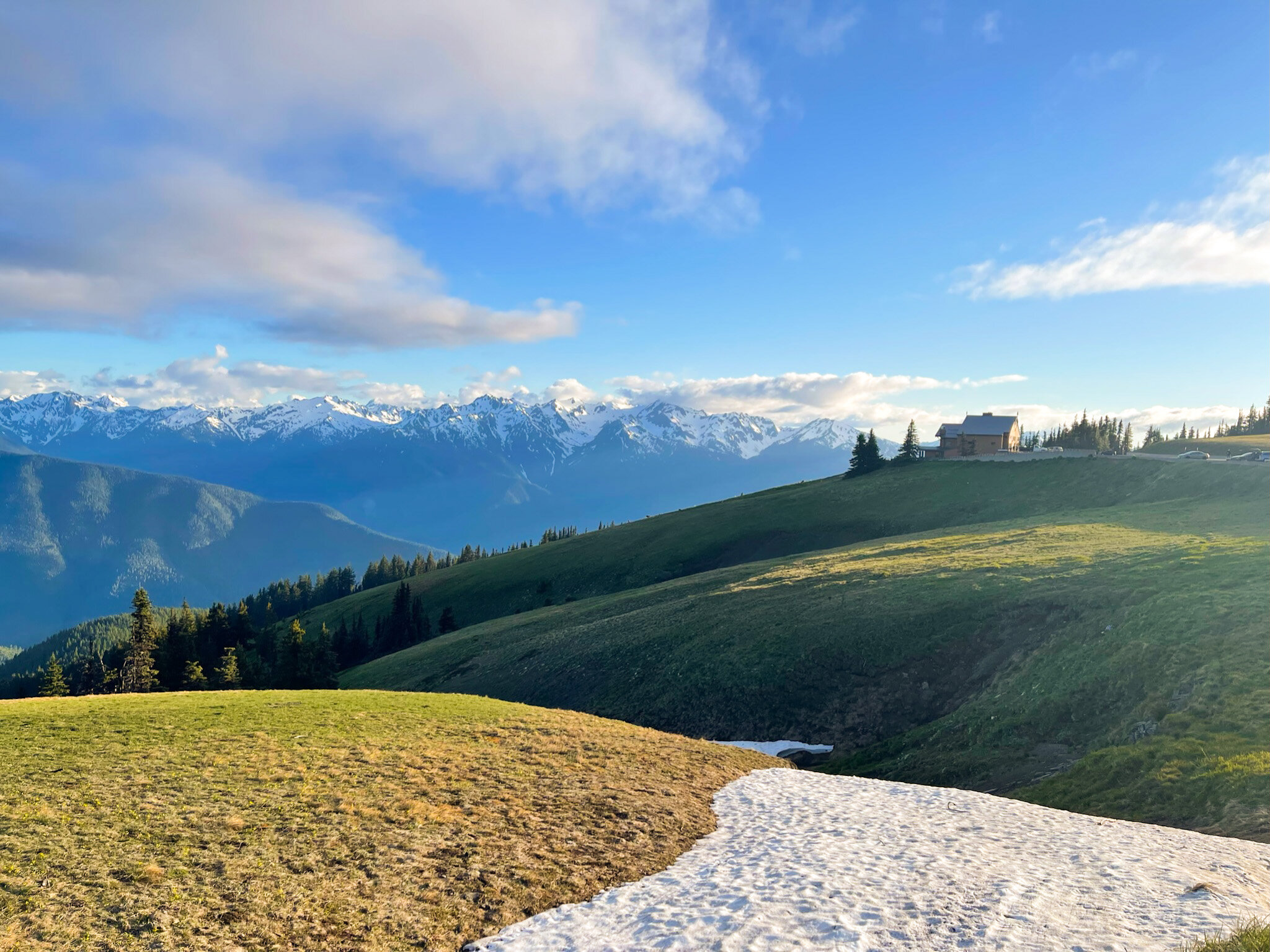
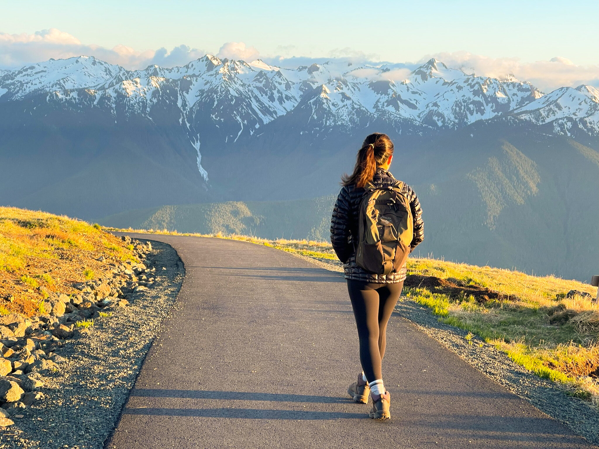
Sunset at Hurricane Ridge is also amazing, and this area is a must visit (just look at the picture above!)
Itinerary
✉️ Want more low-decision travel ideas? Get the free 1-Bag Packing Workbook + Plan & Pack Digest, with practical itineraries, destination guides, and packing tips 2x/month.
Day 1
- Drive from Seattle to Staircase area (2 hours)
- Hike Staircase Rapids Loop Trail (2.1 mi, 213 ft e.g., 1 hour)
- Drive from Staircase to Hurricane Ridge (2.5 hours)
- Hike Hurricane Hill via Hurricane Ridge Trail (3.4 mi, 826 ft e.g., 1.5 hours)
- Stay in Port Angeles at the Angeles Motel (barebones but clean, 4.5 star Google rating)
Day 2
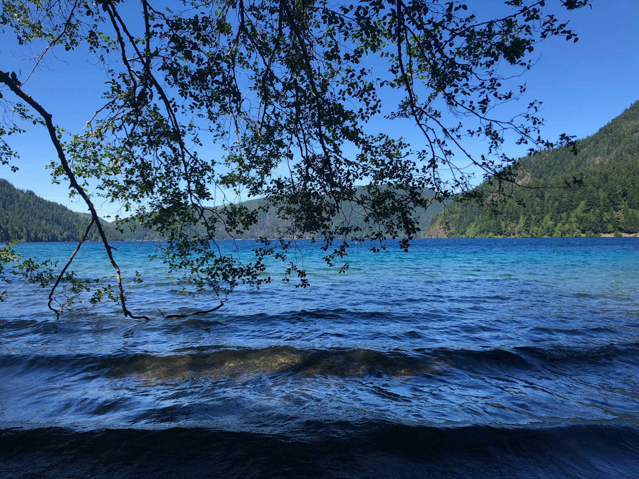
- Drive from Port Angeles to Lake Crescent area (20 minutes)
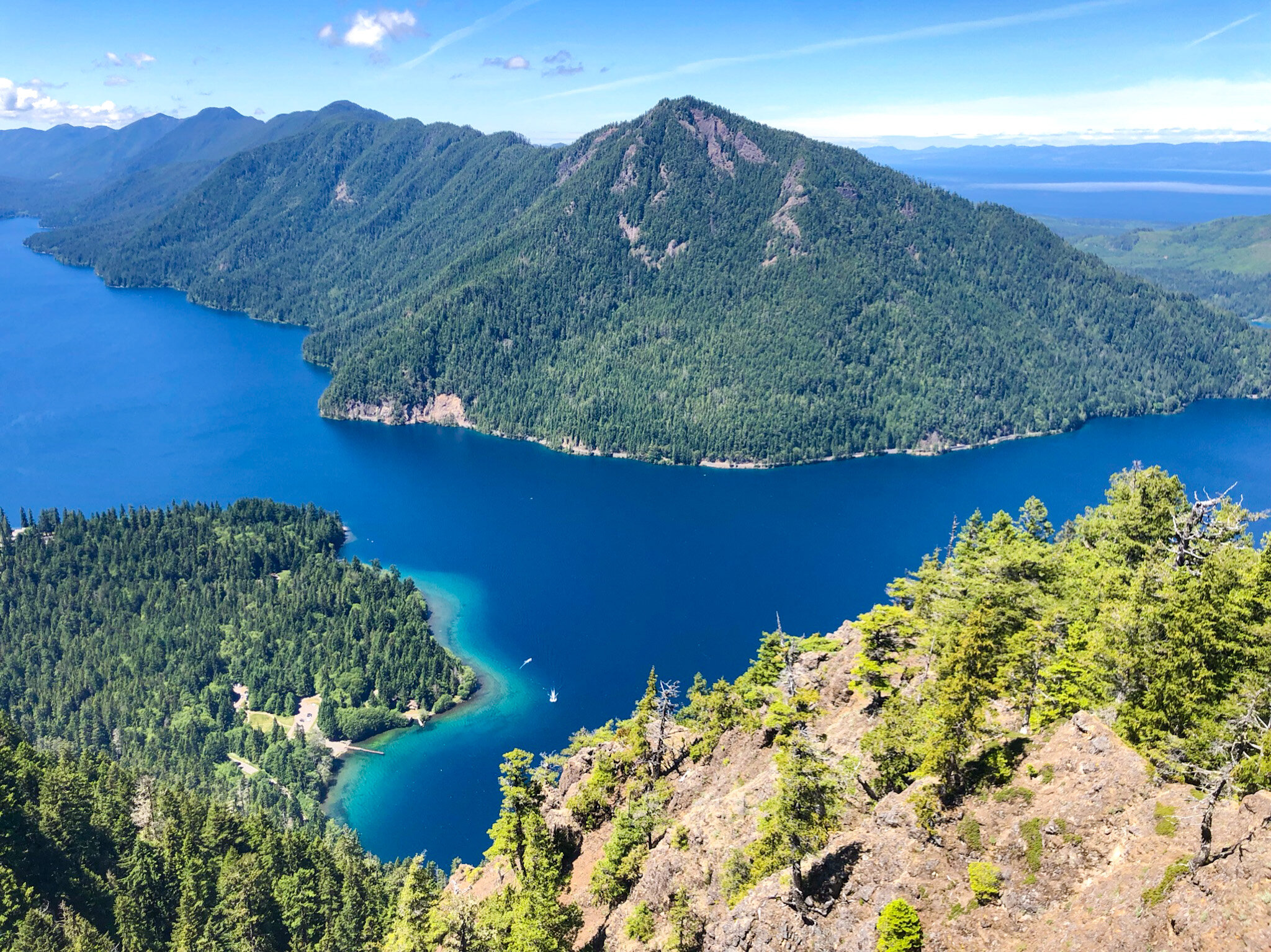
- Hike Mount Storm King (5.3 mi, 2,076 ft e.g., 2.5 hours) + drop by Marymere Falls on the way down
- Drive from Lake Crescent area to Rialto Beach (1 hour)
- Hike Hall-in-the-Wall from Rialto Beach (3.3 mi, 108 ft e.g., 1.5 hours) around sunset
- Stay at Mora Campground (5 min from Rialto Beach)
Day 3
- Drive from Mora Campground to Sol Duc area (1 h 15 min)
- Hike High Divide and Seven Lakes Loop Trail (19 mi, 5,308 ft e.g., 9 hours)
- Camp at Sol Duc Campground (5 min from the Sol Duc trails)
Day 4
- Soak in Sol Duc hot springs (book soaking slots through Sol Duc Campground + Resorts)
- Drive from Sol Duc area to Kalaloch Beach area (1 h 30 min)
- Stop by the Kalaloch Beaches for pristine sands
- Kalaloch Beach area to Quinalt Rainforest (45 min; alternative to Hoh Rainforest Hall of Moss; more on this below)
- Visit Quinalt Rainforest Nature Trail (0.9 mi, 111 ft e.g., 30 minutes)
- Stop by Lake Quinalt
- Back to Seattle! (2.5 hours)
*e.g. stands for elevation gain; mileage and e.v. data from AllTrails; time estimate is from us.

(Map data © Google)
Hikes and Sights
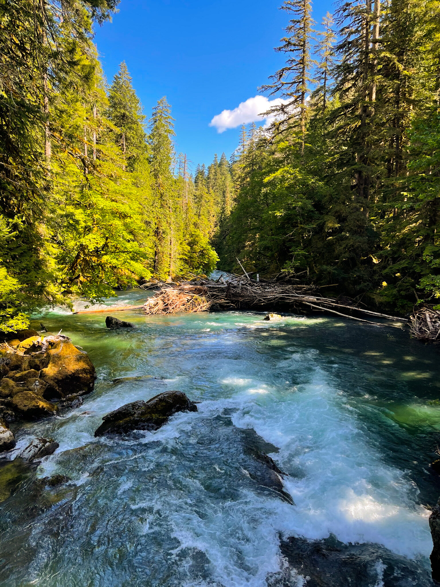
Staircase Rapids Loop Trail
Short and chill hike that features a wooden bridge crossing the rapids pictured below. Had lunch on the bridge and the view is beautiful.
Hurricane Hill via Hurricane Ridge Trail
One of my favorites - right at the parking lot of the Hurricane Hills Visitor Center, rolling hills and grazing deer greet you with the ice-capped Olympic Mountains in the background. It was almost like we were transported to those postcards you see of the Swiss Alps.
The entire trail is paved and pretty wide, and it mostly follows the mountain ridge.
Black-tailed deer all along the way, and most of them were not afraid of us at all.
Some parts of the trail was still a bit icy in June, but nothing difficult.
Sunset on this trail was beautiful. We started when the sun was still up, and gradually the sun rays hitting the hills turned from golden to red.
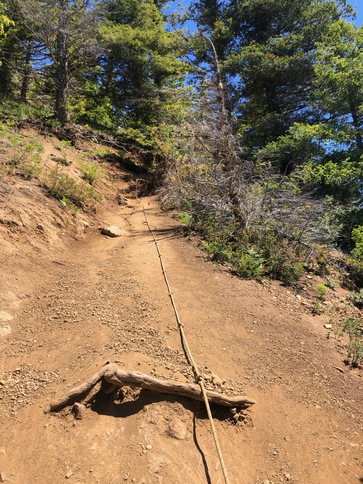
Mount Storm King Trail
The way up is a non-stop ~2-mile climb that’s on the steeper side, so be prepared for quite a workout and make sure to have enough water!
The All Trails pictures of the full view of Crescent Lake at the “top” are a bit misleading. The official trail actually ends before, and you can’t actually get that view of Crescent Lake without going beyond the official trail and climbing a somewhat sketchy rope up a rocky incline. I have deathly fear of heights so I didn’t end up making that final climb.
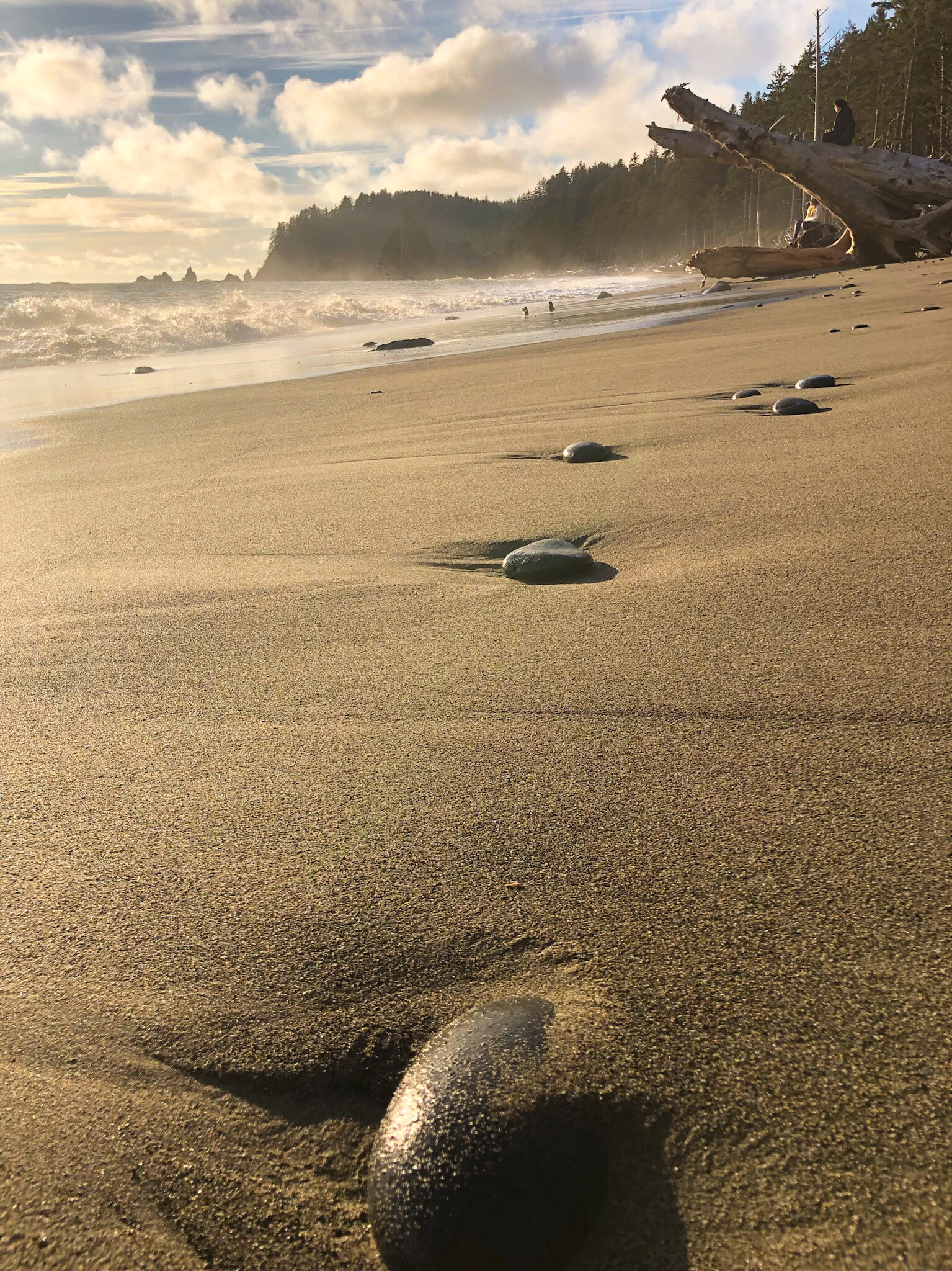
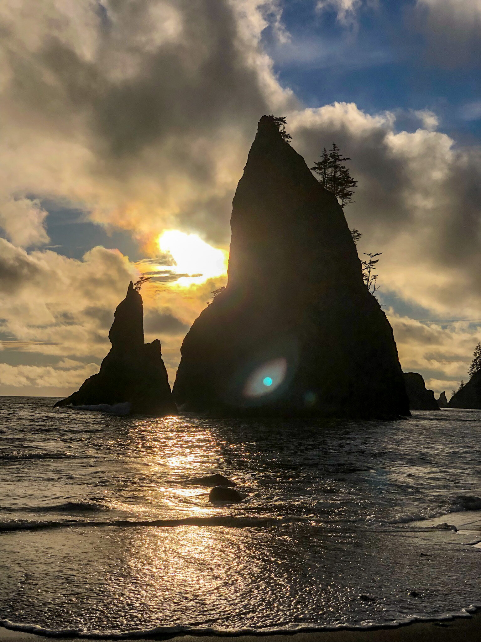
Hall-in-the-Wall from Rialto Beach Trail
We wore beach sandals thinking we’d enjoy walking barefoot on the beach and in the water, but the beach is mostly covered in small stones, so wasn’t too comfortable (quite a foot massage at times though!)
We spotted a bald eagle that circled around the trees and eventually stopped to perch on one.
Sunset on this beach was beautiful, especially seen between the two rock formation.
High Divide and Seven Lakes Trail
Oh man, what an adventure with this one. This was our challenge hike of the trip as we wanted to do this entire loop hike (19 miles with a 4000 ft elevation gain) in one day — it is one of the most popular backpacking trails in Washington.
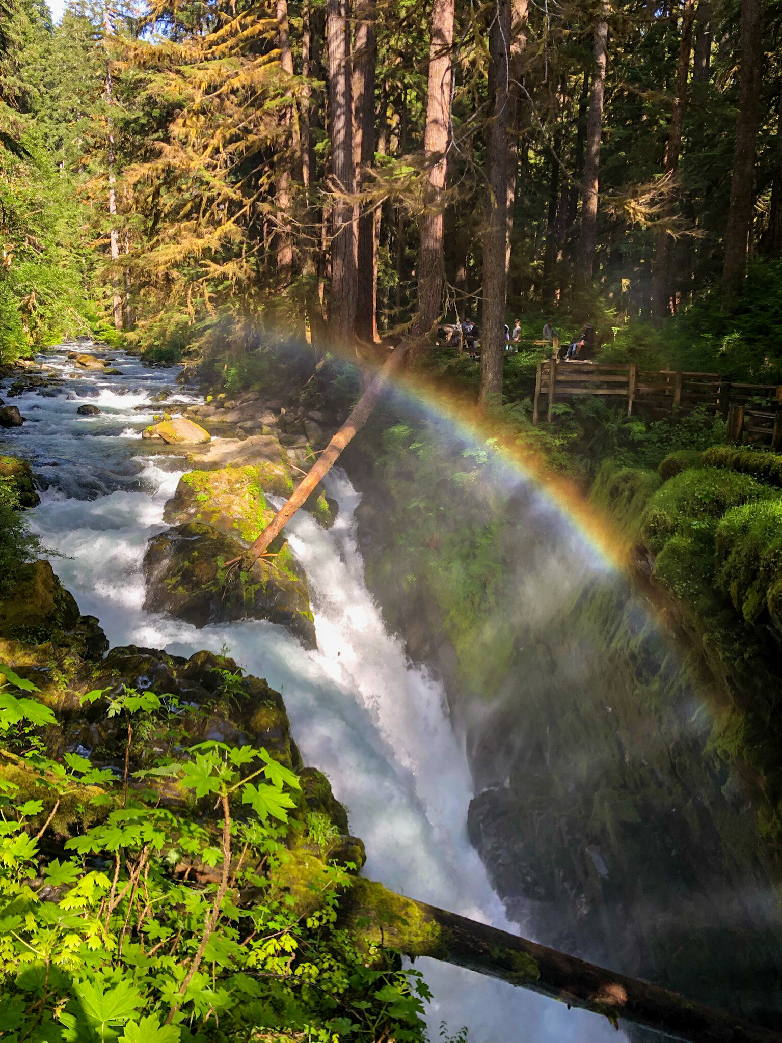
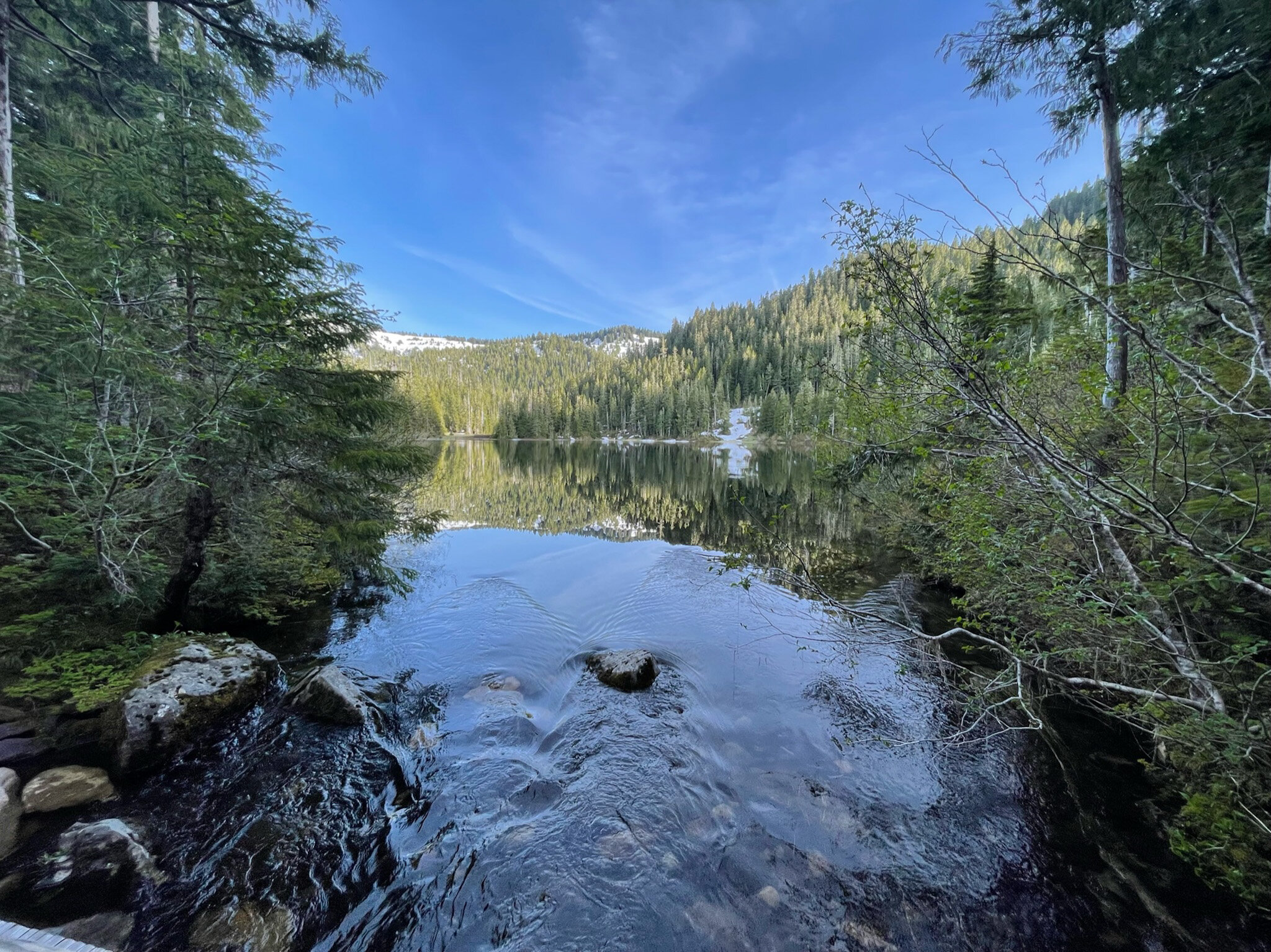
The trail starts at the Sol Duc trailhead. About 0.8 miles in, you will hit Sol Duc Falls, one of the most popular sights of the Sol Duc area. Then, you will see the the junction to enter the loop trail either clockwise or counterclockwise.
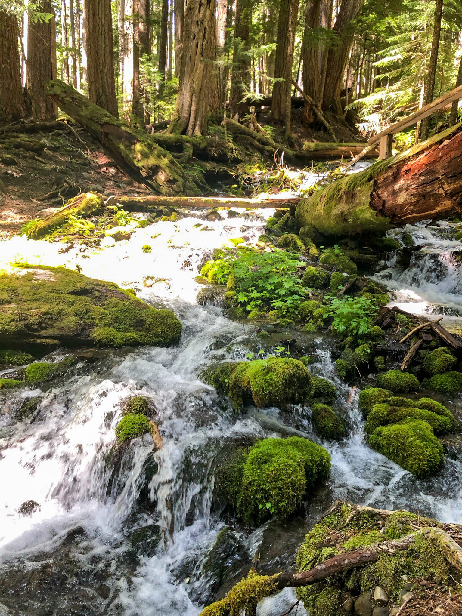
We chose to do the trail clockwise. The first 4-5 miles was relatively flat through a dense forest with exploding green growth (for the entire trip, I could not get over how lush this park is). There was some river crossings too. Then, the trail started to climb.
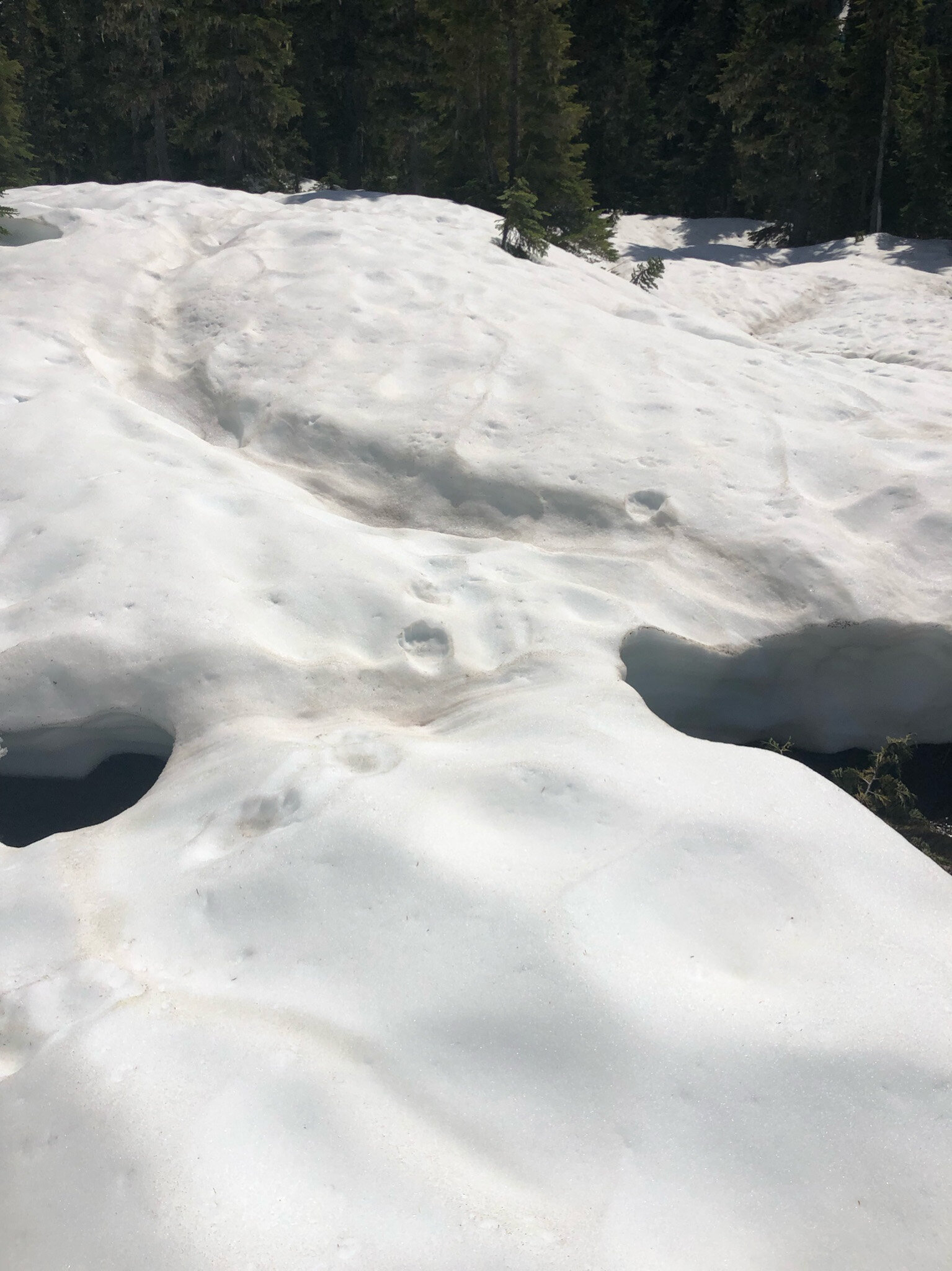
However, past 4000 ft., snow on the ground made it impossible to determine where the trail was. The snow was still several feet high but was no longer packed, so at multiple points where we didn’t test our foothold properly, we almost fell through. Adding onto that, we started seeing bear prints on the snow, and at that point, we decided to retreat and turn back.
By the time we reached the junction, we’ve already hiked about 15 miles. However, given that lakes are featured on the trail and we did not see one, we decided to go in the counterclockwise direction and hike up to Deer Lake, which was another 6 miles or so round trip.
So, we actually ended up hiking closer to 22 miles that day. A bit sad we didn’t get to do the high divide part, but still had a blast. Can’t wait to come back during proper summer and do the whole thing.
And, probably because it’s not high season yet, we only saw one other group of people during the first part of our hike, which was pretty cool.
Kalaloch Beaches
Wide expense of pristine grey sands, fog, and very few people. Enough said.

Quinalt Rainforest Nature Trail
Technically part of Olympic National Forest.
Need a National Forest Day Pass ($5) or Annual Pass ($30) to enter.
Interpretative trail with informative signs all along.
Interested in more national park itineraries like this?
Check out my Crater Lake National Park 2-day Itinerary for an epic trip to Oregon’s only national park!
Have a question about this or planning something similar?
Shoot me a message or leave a comment below — I read everything, and I’m always happy to help if I can!

![Crater Lake National Park: 2-Day Hour-by-Hour Itinerary [Updated 2025]](https://images.squarespace-cdn.com/content/v1/59494a70ff7c504114292d44/1627751960584-23RH5V2P9D8ADQL017SG/IMG_0111+2.JPG)